|
I have made many trips to the Berchtesgaden area (in Southern Germany) over the past few years and during those visits I have returned to the Rossfeld mountain on many occasions. It is just a stunning destination.
During my September 2019 trip to Bavaria I stayed for a few nights at Villa Bello in the small village of Oberau, a perfect location for accessing various attractions in the area and especially close to Rossfeld.
At around 1600m the summit of Rossfeld is not particularly high compared to some of the surrounding mountains but it is a fantastic place to visit and has a number of key advantages as a photography location.
The most important advantage is accessibility. The road which leads to the summit is wide, well maintained, safe and easy to drive, with ample parking at the top and multiple stopping places on the way up or down. The road is a ring, the ends of which can be accessed from Oberau (850m altitude) or from Obersalzburg (750m) and you can drive your car all the way up to an altitude of 1570m.
This accessibility makes the destination suitable for anyone who can drive a car or get on a bus, spectacular views can be had in many directions at different points on the route without even leaving the vehicle.
For anyone who has driven on a lot of other mountain roads in (e.g.) Germany, Austria, Slovenia, Italy or Switzerland the Rossfeldpanoramastrasse road is the height of luxury. Perfect surfaces, a wide two-way carriageway, relatively gentle corners and a lack of surprise entrances or blind spots make this a very safe road. For first time mountain drivers a degree of caution should be exercised and special attention should be paid to the speed of travel (especially on the descent). The road is kept in such perfect condition by the collection of a toll, at time of writing access to the road costs €8 for a passenger car. Click here for more information about Rossfeldpanoramastrasse. What can you see from Rossfeld?
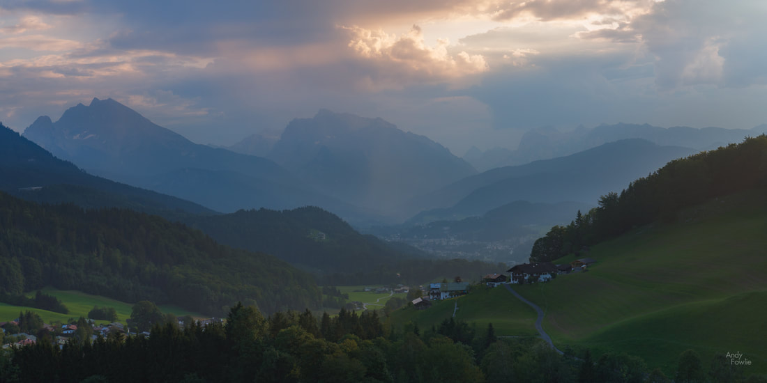
The great peak of Hoher Göll (2522m) is Rossfeld's close neighbour (to the south west) and it is a very imposing sight from the top of Rossfeld, appearing immediately adjacent despite being a few kilometres away.
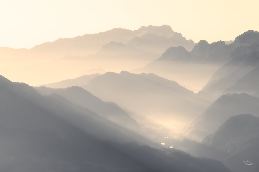
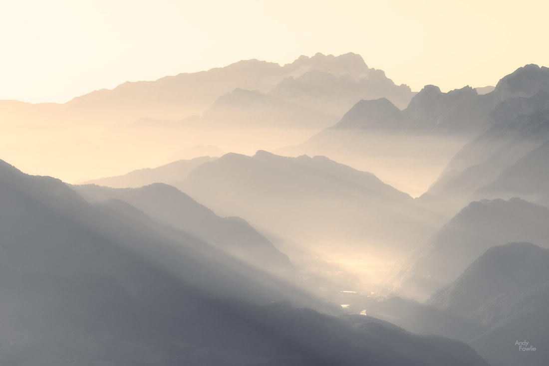
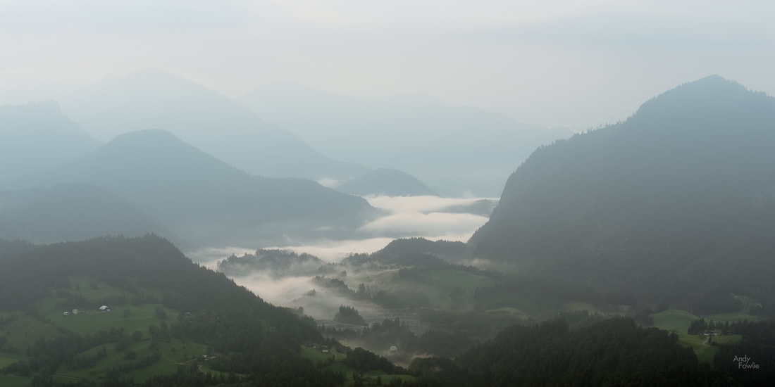
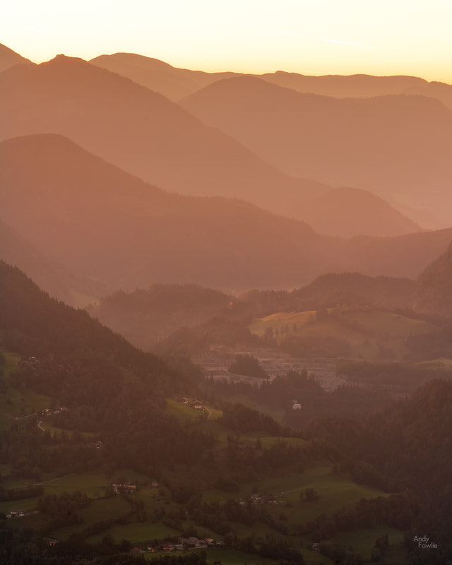
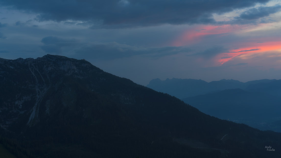
The Göll massif is the first in a sequence of mountain ridges which decorate the landscape in the sweeping views which are available to the south-east from the summit of Rossfeld, following the valley of the Salzach river. On a clear day it is possible to see past the peaks of the Tennen mountains and past the hills from the Salzach valley all the way to the the mighty Dachsteinn (2995m) some 70 kilometres away. On hazy mornings these beautiful layers of mountains are a superb subject for photography.
Turning your gaze to the east from the summit of Rossfeld you can get views of the lush valley below with some interestingly shaped hills.
This valley is flanked on the other extreme by more mountainous ridges (the Totes mountain range). These views are also stunning although the valley is often in shadow at both sunrise and sunset.
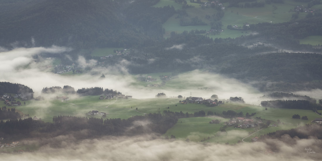
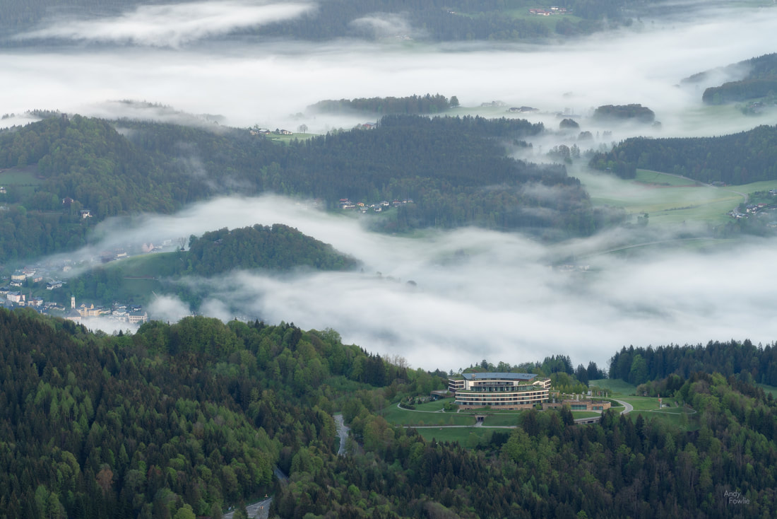
The scenery to the north-east is a little more gentle, a flatter (but not flat) plain with villages and fields, often likely to be covered in fog in the mornings of spring and autumn.
The historic Austrian city of Salzburg lies some 20 kilometres to the north of Rossfeld, and it is possible to catch some distant views of the city, including the airport which is quite easy to identify due to the landing lights. To the north-west you can see a side on view of another huge iconic lump of rock, the Untersberg, topping out at 1973m.
As we complete the circle there are views of distant mountain peaks and some glimpses of buildings in the valley below, a highlight is the rounded form of Kempinski Hotel Berchtesgaden which looks like it could be either the new Apple headquarters or the lair of a James Bond super villain.
Overlooking this area, perched on the mountain above Obersalzburg, you can catch a glimpse of the Kehlsteinhaus or "Eagles Nest", a nazi stronghold from the 1930s. The Kehstein mountain is a sub-peak of Hoher Göll.
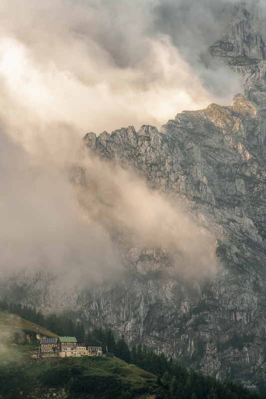
Hoher Göll itself is a popular climbing destination, offering a variety of different routes to to summit, from the pretty easy to the pretty challenging. The Purtschellerhaus, perched beautifully a few hundred vertical metres below the summit, provides a welcome staging post for climbers and a point of interest for any photographers who might point a lens in that direction from Rossfeld.
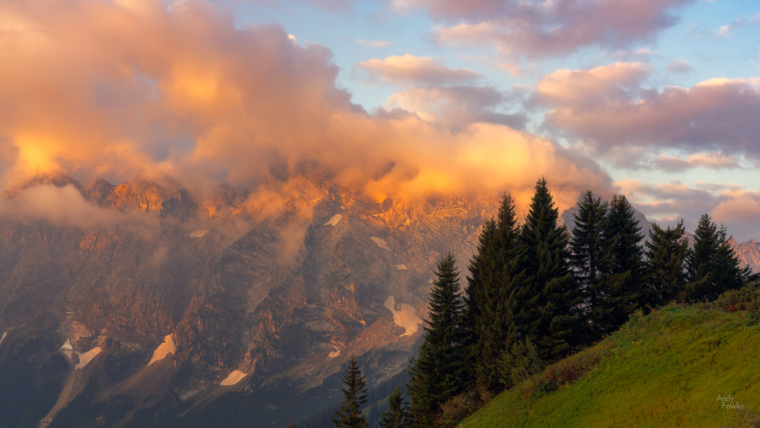
The range of different heights in the surrounding mountains means that you often have some feature or another which is in the clouds at Rossfeld. This can be a great bonus for photography. I particularly liked how the clouds were gathering above the Purtschellerhaus on this September morning so I captured their motion in a time-lapse.
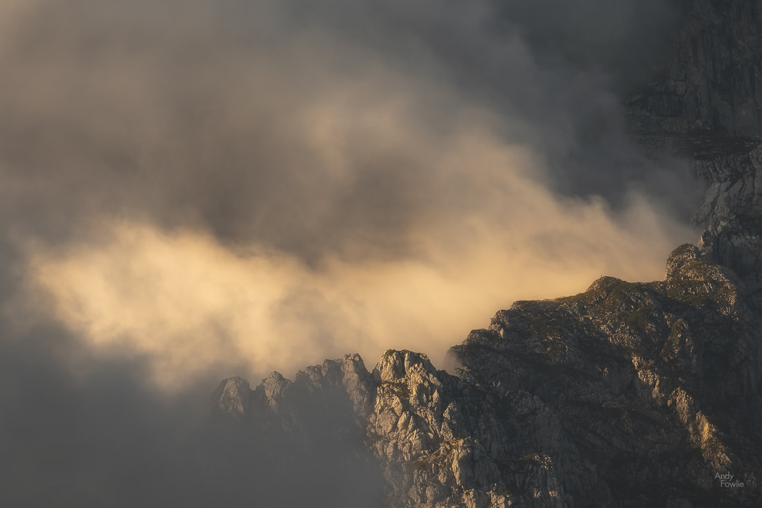
The jagged rocky slopes also give great opportunities for dramatic images when the clouds are performing for the camera.
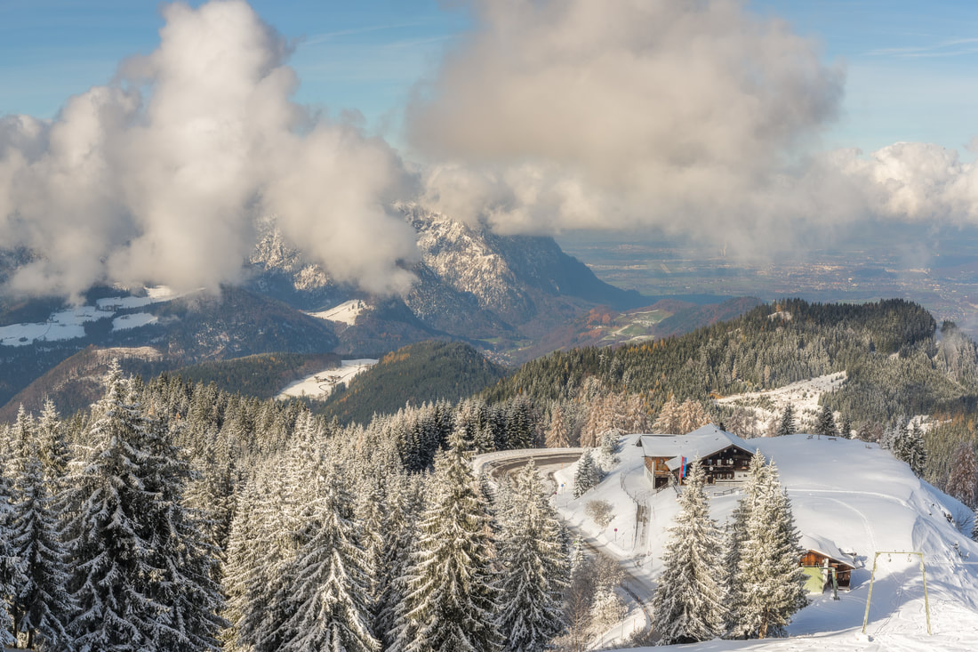
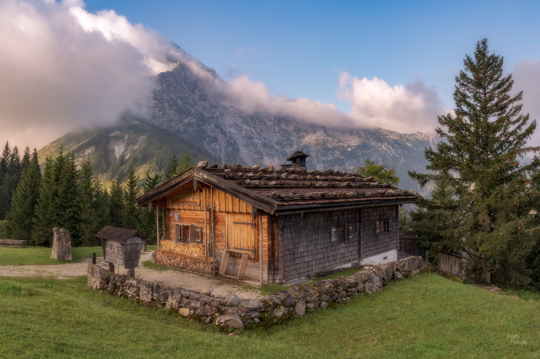
Now that we have covered the 360 degree attractions of Rossfeld it is only proper to mention the highlights of the mountain itself. The Ahornkaser is the highest tavern in Germany that you can reach by car and it offers a chance to get refreshments while on the mountain. It is also a good vantage point for photography with a charming mountain cottage nearby that has Hoher Göll as a great background.
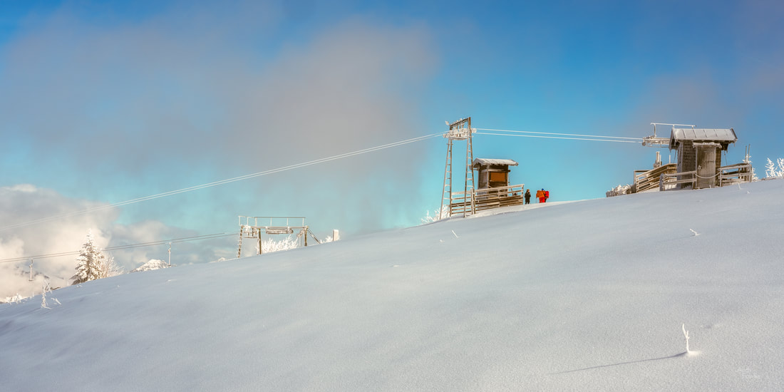
The views that you can enjoy from Rossfeld are available all year round thanks to a dedicated effort being made to keep the road clear. I have previously visited during times of heavy snowfall and still been able to drive without any difficulty to the summit. Indeed the slopes on the north of the mountain are an active skiing area with beautiful panoramic views.
I hope that this introduction has made you eager to visit Rossfeld, it is one of my favourite places to take photographs because there are so many compelling possibilities in one easy to reach destination. I look forward to returning to Rossfeld in the future!
Until next time, Andy You can also find me here
Recent Posts
2 Comments
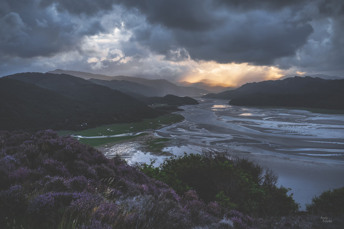
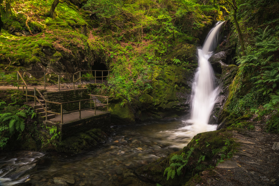
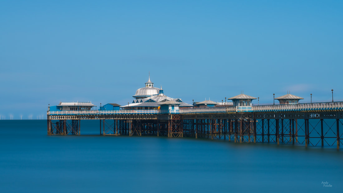
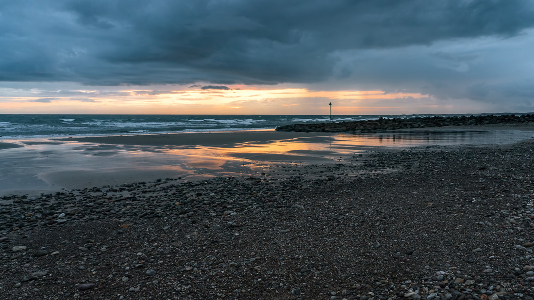
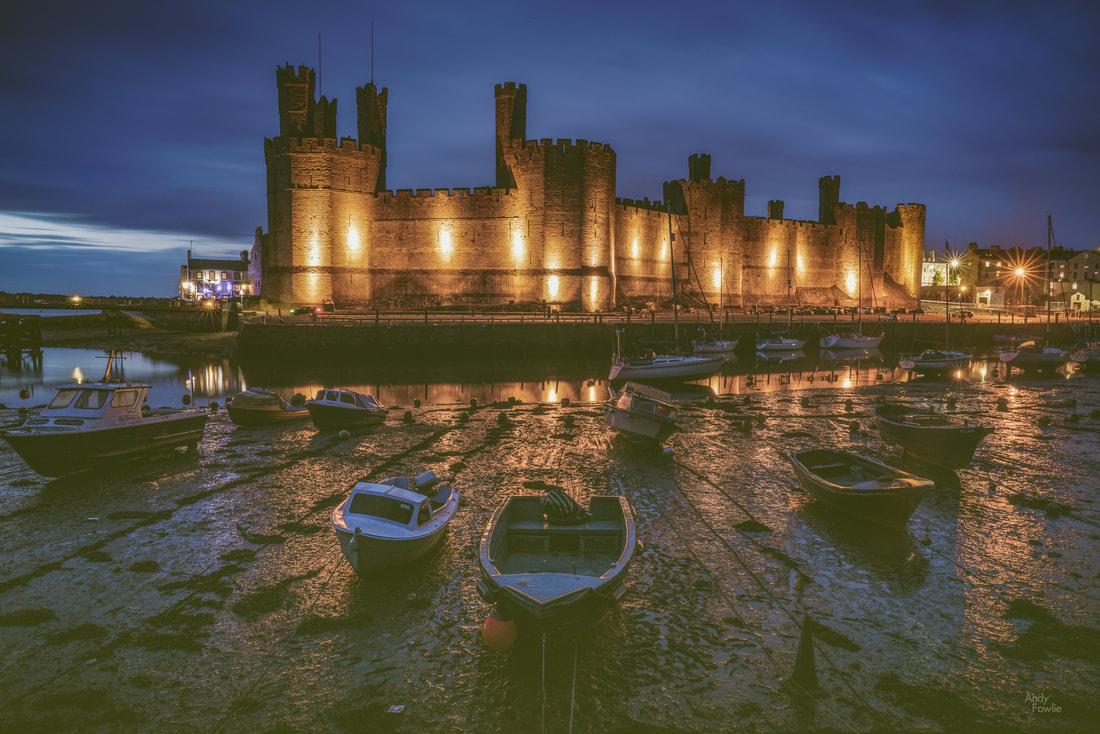
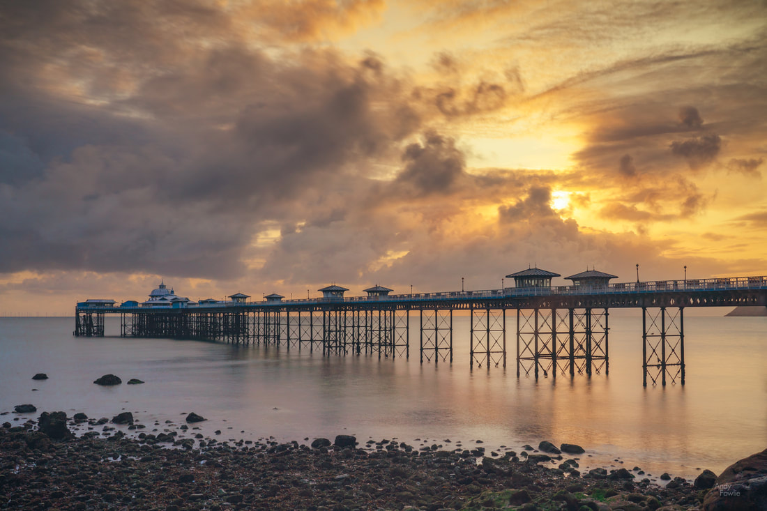
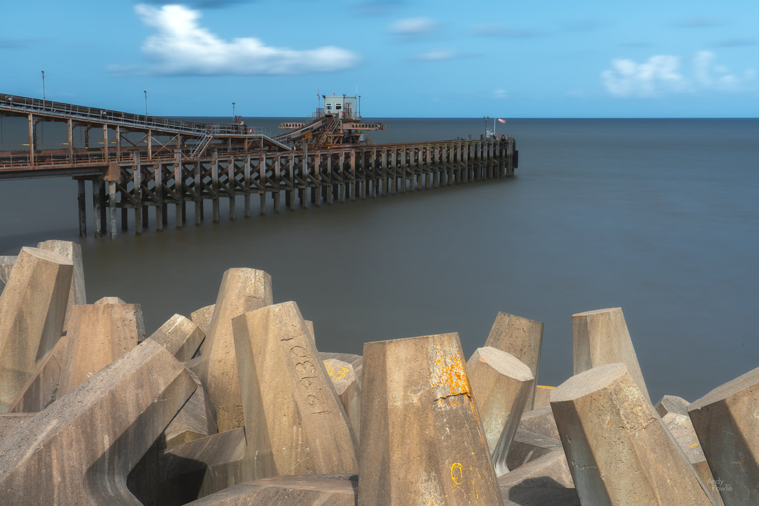
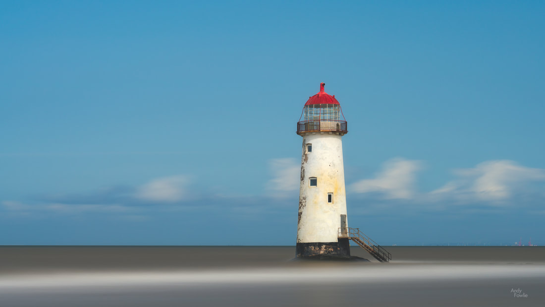
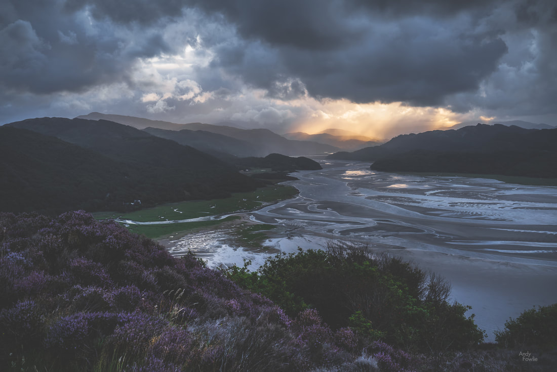
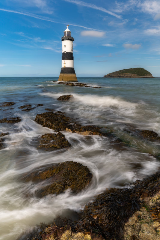
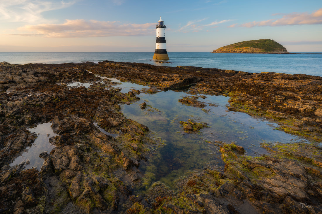
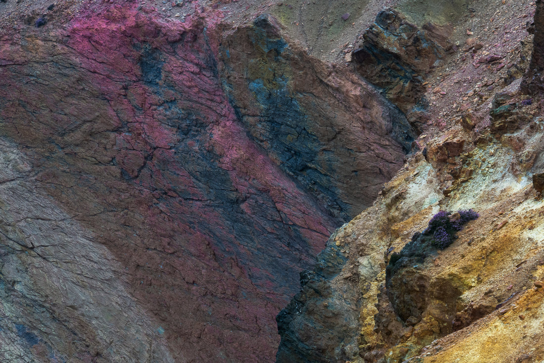
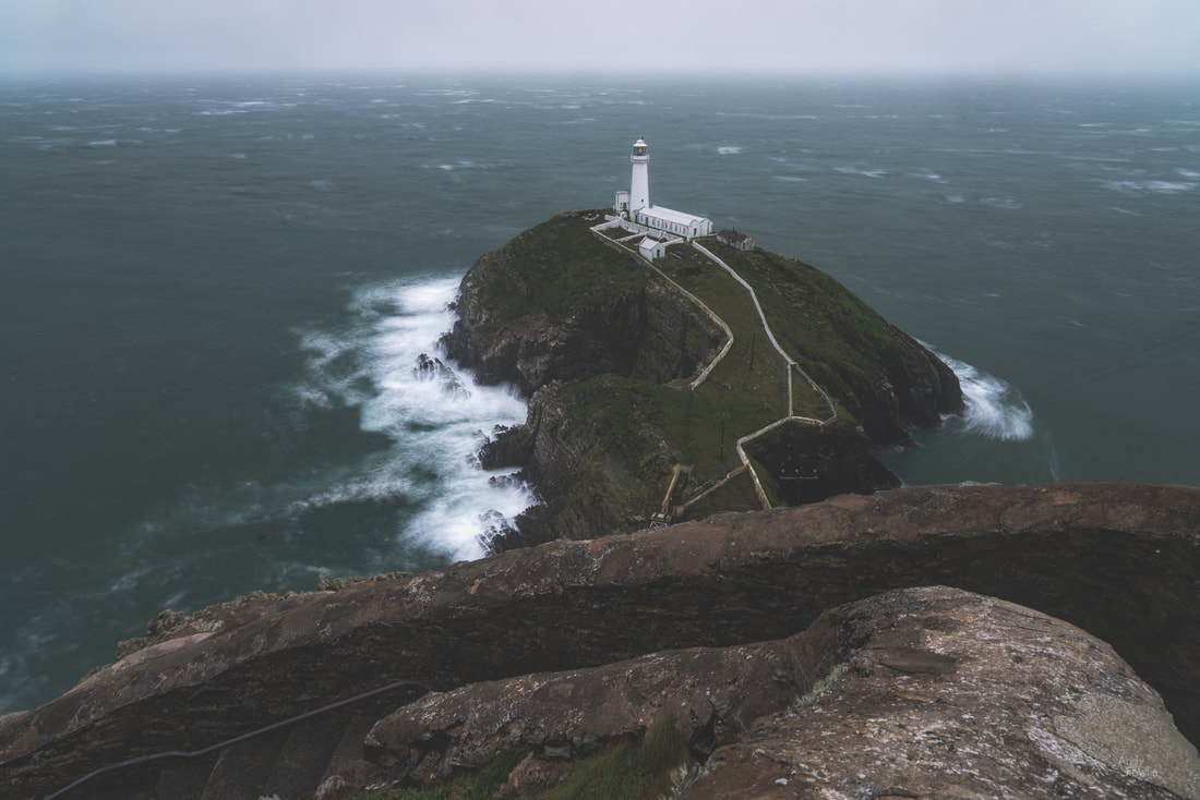
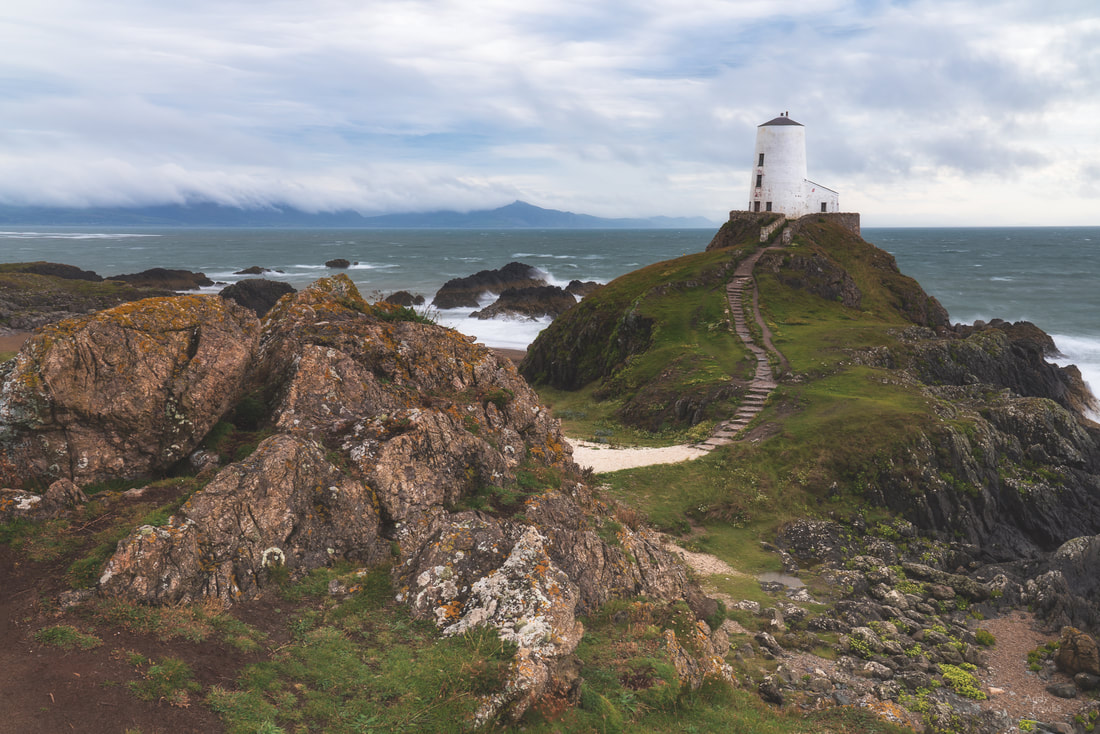
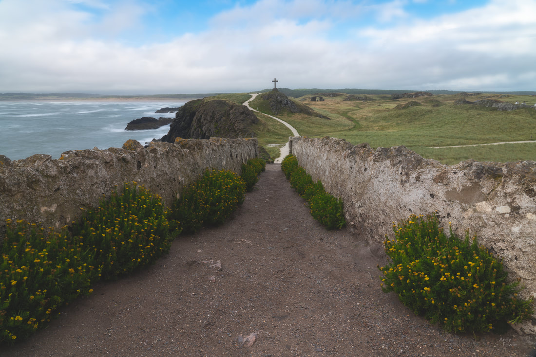
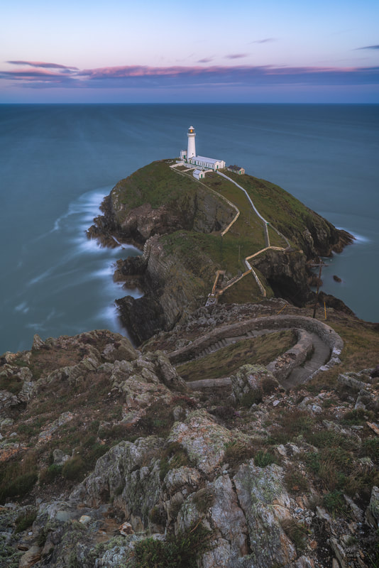
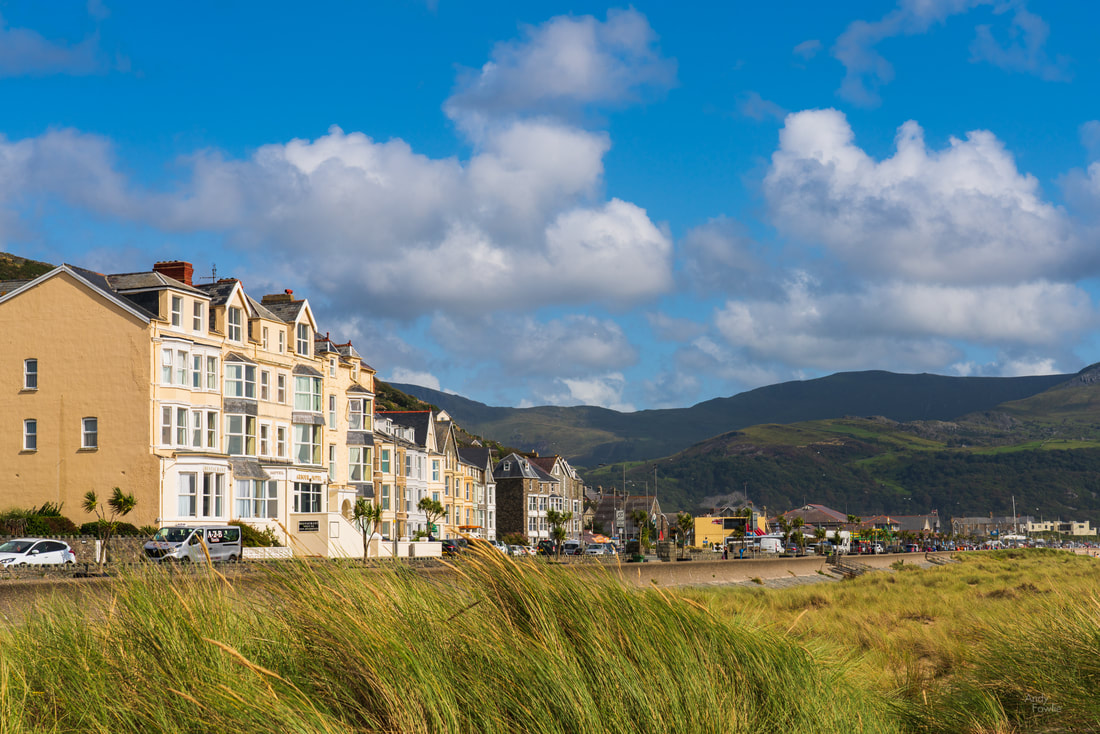
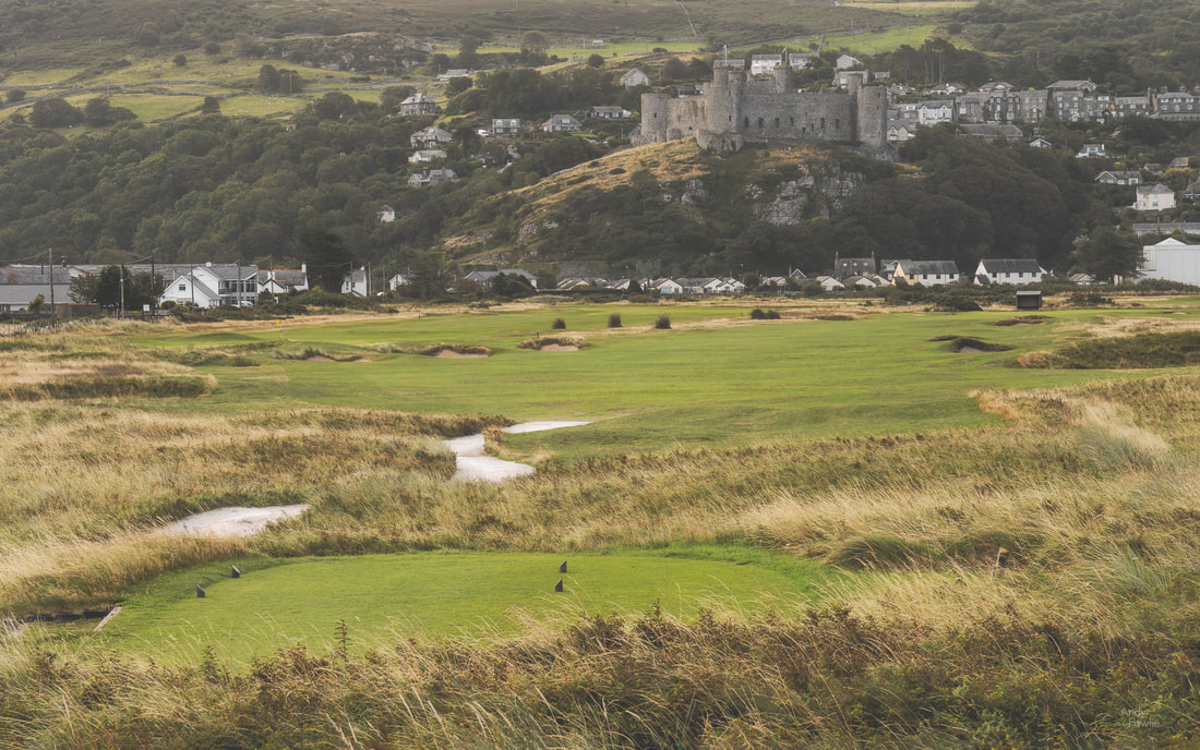
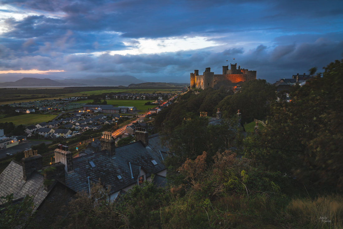
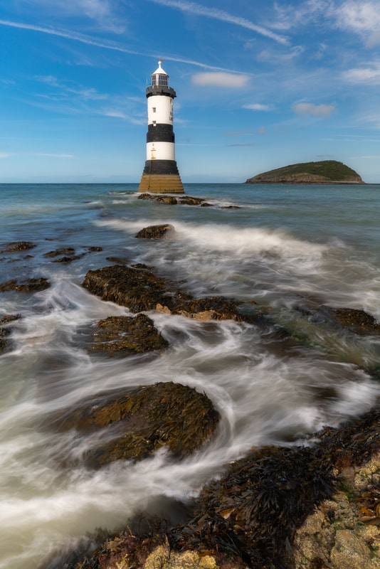
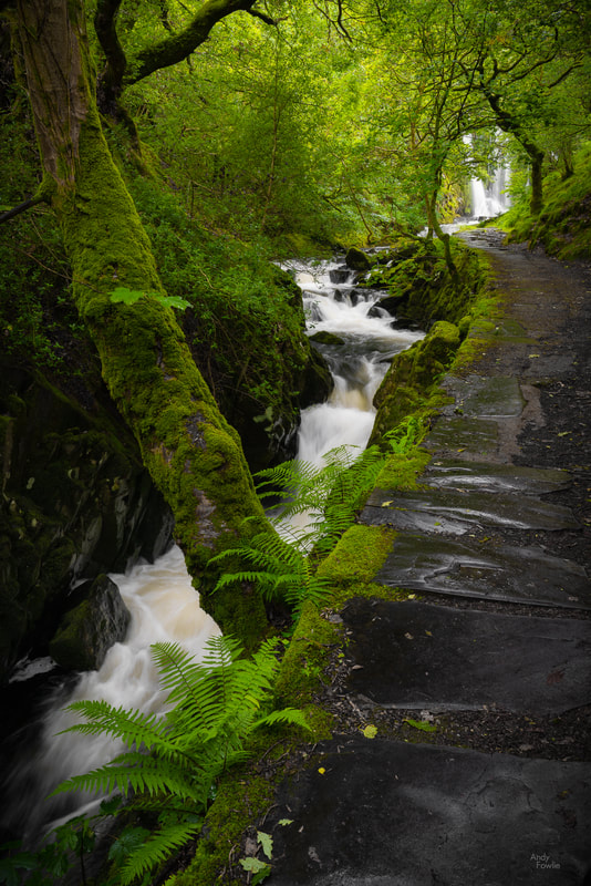
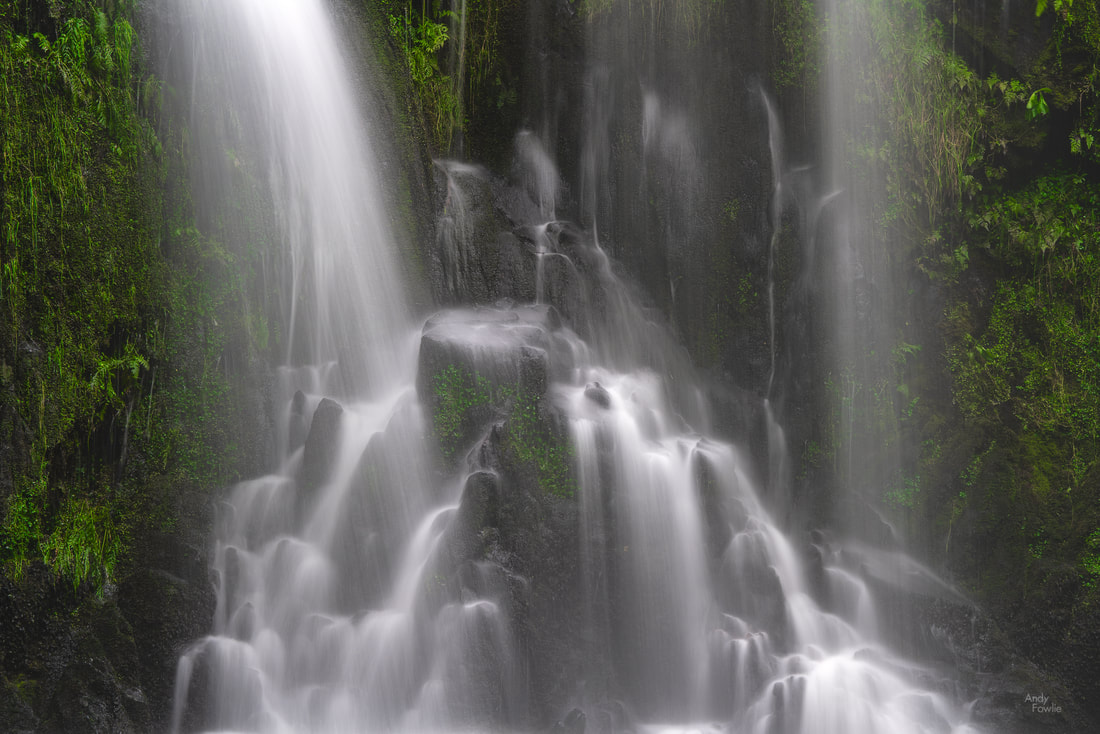
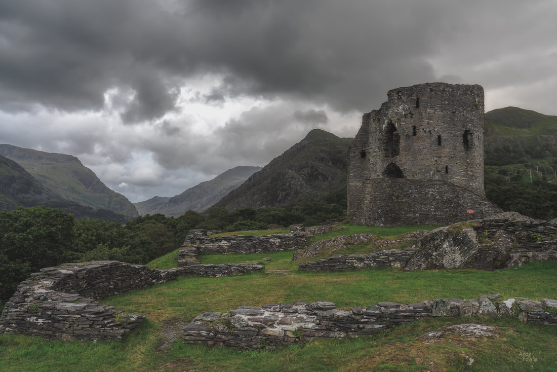
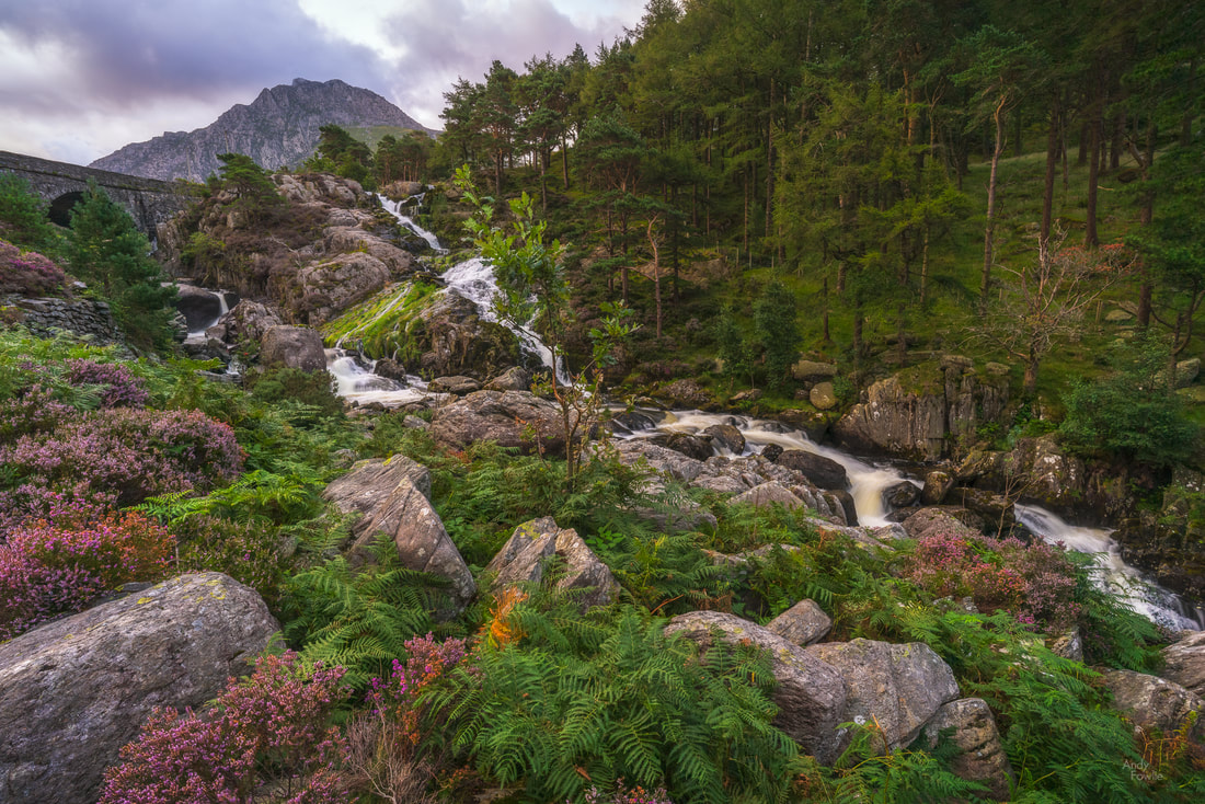
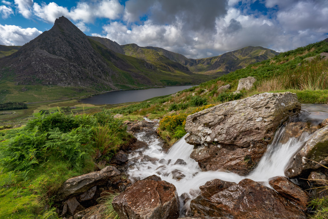
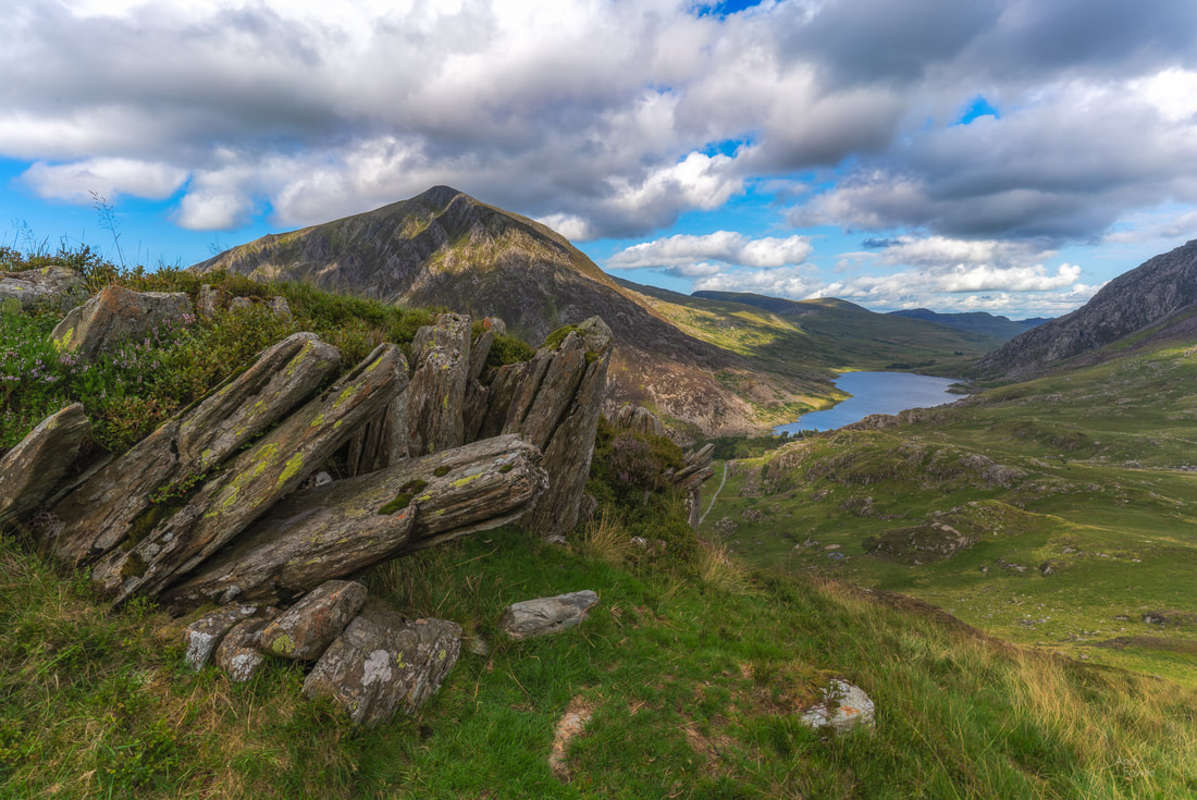
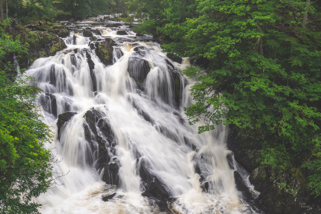
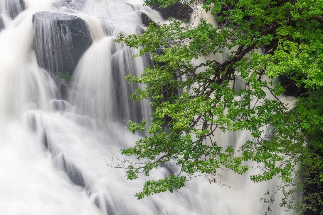
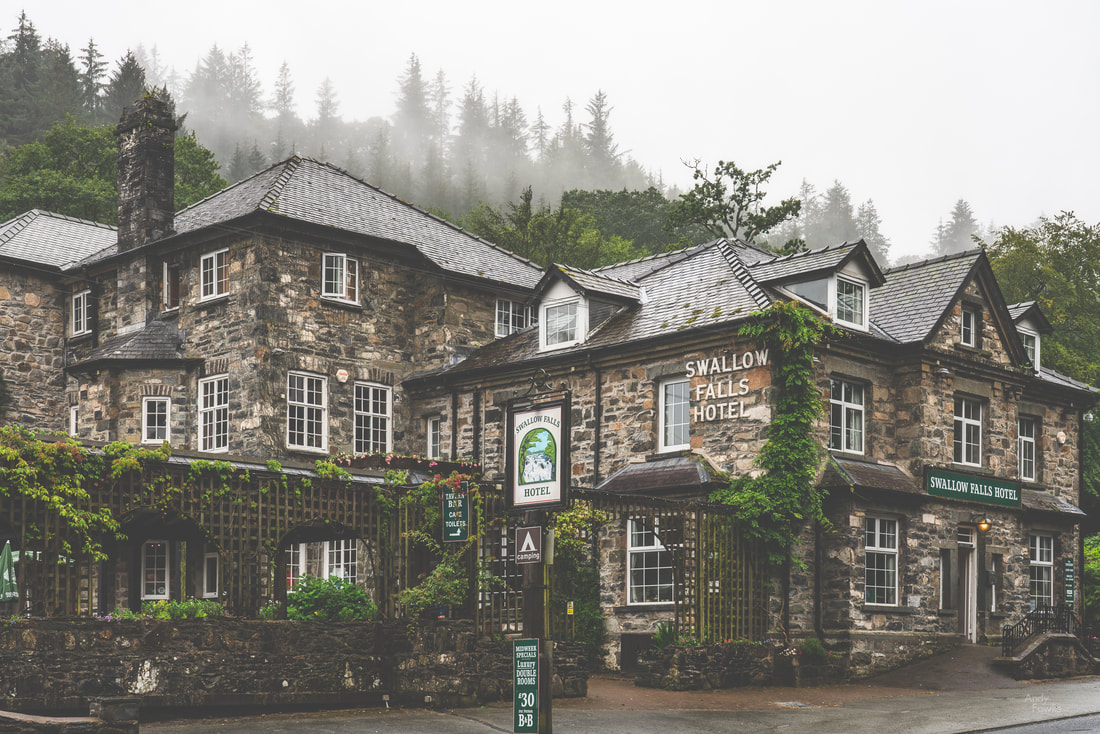
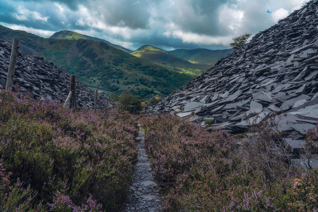
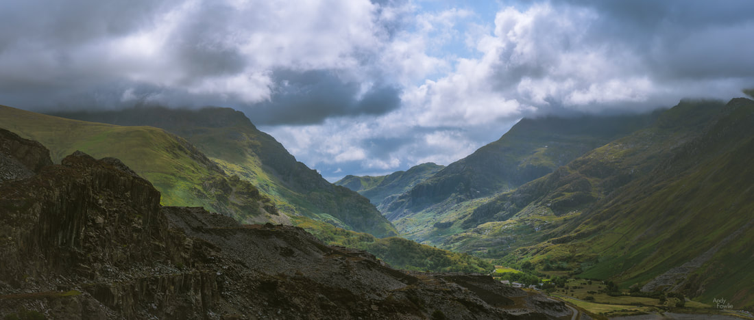
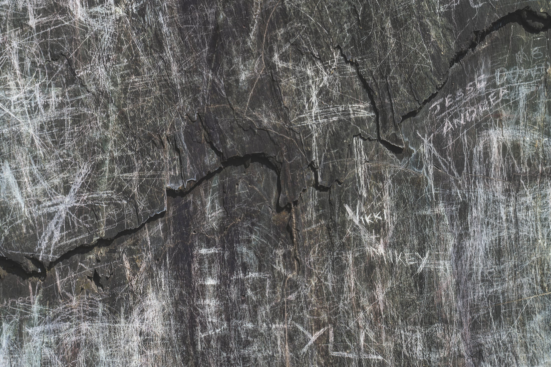
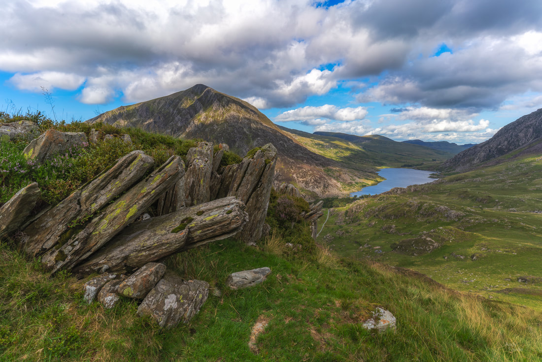
At 0345 my alarm sounded. I did not even have to open my eyes in order to judge the weather conditions, the wind was hurling raindrops with remarkable ferocity against my west facing window in the Fron Deg Guesthouse. A beautiful sunrise seemed monumentally unlikely. On days like this it can be overwhelmingly tempting to stay under the covers and start the day with a lazy breakfast instead of some foolish adventure. Six or seven minutes later i was on the road, heading towards a location near Barmouth. After a 30 minute drive, the final section of which took me up a rather narrow track, I started hiking through a forest in the darkness, following a trail which should deliver me to a viewpoint. The rain was intermittent, but did not cause much hardship while I was under the cover of the tree canopy. As the ambient light began to reveal more of my surroundings I got my first few glimpses of the Mawddach estuary through some gaps in the trees. As the trees gave way to heathery scrub at the top of the hill the full panorama revealed itself, but the weather conditions were ugly and boring. I took a few shots, without much enthusiasm and then got distracted by some interesting rocks and tried to find abstract patterns to photograph. At least I had got myself out of bed, and had a nice morning walk. I decided to head back for breakfast. I walked back down the hill a bit... then changed my mind and decided to use the time to practice shooting timelapses, something I have been meaning to get into. I set a timelapse going and then resumed my seach for patterns in the rock. A few minutes later I looked up and saw that the sun was starting to fight it's way through the clouds... a magnificent sight. My timelapse was still running, and indeed it had captured the progression of this elemental battle as raged above the estuary, driven on by the westerly wind. Timelapse photography involves shooting a large number of images of a scene and then using those images as frames in a video. The resulting footage has some noticeable differences to normal video content, the most striking of which is that it can be used to show changes over a significant length of time in a relatively short clip. The timelapse above is made from 900 images, captured once every 2 seconds over a period of 30 minutes, the resulting footage has a duration of 30 seconds. I have done some experiments with this kind of work over the past few trips and start to be more proficient with both the capturing and processing of timelapse footage. I think that there will be the occasional timelapse to be seen in my future posts. There is nothing much better than the feeling you get when sitting down to a good breakfast with the thought that the day has already been worthwhile. The morning routine following a sunrise excursion has a familiar pattern - cereal, sausage, bacon and eggs, toast, orange juice and coffee... probably more coffee... copy the morning's pictures to my laptop, charge batteries, shower, get dressed and head out exploring. My next destination was a bit of a drive away, I followed the road along the coast, around the Mawddach estuary and into the countryside to Dolgoch Falls. This beautiful forest waterfall has an excellent cafe (the Dolgoch Tea Rooms) nearby and some possibilities for a bit longer walks nearby. I sometimes get asked about how my images are processed, and that seems to be one of the major topics of debate in the photography community as well as in the looking at photography community. A few weeks ago I wrote down my own thoughts about such discussions in a short article that you can read here. As a follow up to that article, for those who prefer to see some concrete examples, I made another post showing a before and after comparison for two finalised images (including the one above). For the final couple of days of this most enjoyable trip I moved my base of operations to the town of Llandudno, where one of the attractions is a grand old pier. Most of the places that I found interesting in this area were beside the sea. There are many beaches and coastal areas, each with different characters and features. The long, west-facing, rocky beach at Dinas Dinlle was a great place to watch the sunset and it also has a decent fish and chip shop right next to the car park... what more could anyone possibly want? Another feature of this area is remarkable castles, two particularly fine examples are preserved at Conwy and Caernarfon, both of which date from the 13th century. By this stage of my journey the constant late night-busy day-early morning routine was starting to have a cumulative effect. In autumn and spring it is quite possible to go on almost indefinitely shooting both sunrise and sunset every day, but in summer the period between those is just too short to get enough sleep. It was something of a relief to have the possibility to get to my sunrise destination the next morning with a 400m walk from my accomodation instead of a long journey. On my final full day in Wales I decided to explore along the north coast, stopping first at Llandulas beach where there are some interesting coastal defences. Thousands of huge concrete blocks, shaped something like jacks (from the classic game, it's just a matter of time before modern youngsters leave their devices behind and return their efforts to games like this), are piled up along a 7 mile stretch of coast. The most obvious, and already much photographed, landmark to add to any picture of these sea defences is Raynes Jetty, a structure extending out to deep waters in order to allow cargo ships to be loaded with the products of the nearby Raynes Quarry. At the most northern extreme of the Welsh mainland you can find the golden sands of Talacre beach and their crowning glory, the Point of Ayr lighthouse which sits out in the surf, about 50m offshore, at high tide but can be approached on foot across the sand at low tide. My first visit to North Wales was a most enjoyable one, and I am sure that i just scratched the surface of what it had to offer. I hope that I can return one day, maybe in some better conditions so that I can explore more widely in the mountains of Snowdonia. Thanks for your attention and support! Until next time, Andy I am not sure if I will still have any readers after offering extensive thoughts on the art of cricket commentary in my last post, but if anyone ever reads this then please know that I am most grateful for your patience. Having left Snowdonia behind I made my way north and west to spend a few days on the island of Anglesey. Anglesey is a significant chunk of rock (about 715 square kilometres in area) just off the west coast of the Welsh mainland and it can be reached by road using either the 19th century Menai Bridge or the 20th century Brittania Bridge, both of which cross the Menai Strait just to the west of the city of Bangor. The first location i visited was Penmon Point, at the eastern extreme of the island, here you can find fresh air, sea views and pleasant walks while the Pilot House Cafe can satisfy all your on-site refreshment needs. Lighthouses can make for interesting photographic subjects, often providing the vertical element in an otherwise level environment and frequently positioned in slightly wild locations, surrounded by rocks, cliffs and crashing waves. This would not be the only lighthouse of my time in Anglesey. When planning my trip I had decided that two nights would be spent in Anglesey, meaning that I had an arrival day, a full day and then a departure day. My full day in Anglesey just happened to coincide with the arrival of a major storm. There was fairly persistent precipitation to deal with but the bigger photographic difficulty was caused by monumentally strong winds (67mph = 107kmh =30m/s). Tentatively I headed out into the storm, slightly comforted by the fact that the chances to get my destinations to myself were significantly higher on a day like this. After a completely miserable "sunrise" at Penmon and a restorative breakfast the first location of the day was the old copper mine at Parys Mountain. At a location such as this, a massive open cast mine, there can be some challenges to understand how to capture the character of the place in a photograph... in essence the location is just a huge shallow hole in the ground. To me the most interesting aspect of the scenery was the amazing colours of the soil and sediment, caused (as far as I can find out) by the presence of metallic oxides. The wind was far too strong for even a heavy tripod and the driving rain was an impediment for shooting in many otherwise possible directions so I was reduced to capturing quick hand-held shots inbetween attempts to clear the moisture from the front element of my lens. It is both a benefit and a matter for some regret that i have had so many opportunities in 2019 to develop such techniques. Despite the weather Parys mountain was a most interesting place to visit. I do enjoy being out and about at interesting locations no matter what the weather conditions may be and I expect to encounter a variety of conditions over time, 2019 has however been remarkable for a lack of variety as heavy rain and strong winds have been a constant companion. I shall endeavour to ensure that my posts contain something of interest (ok, ok, no more cricket stuff) in addition to complaints about the weather. My journey continued and I drove towards Holy Island (a 39.4 square kilometre island located just west of the island of Angelsey, which is located just west of the British mainland which is an island just to the west of the European mainland) from where I intended to photograph the lighthouse at South Stack... which is located on a tiny island just to the west of Holy Island. The path leading down the cliff side to South Stack from the car park is completely exposed to the worst of the elements. The stone walls to the side of the path protect you well from any accidents, but the wind made shooting of any kind exceptionally difficult, 95% of my attempted pictures ended up as a blurry mess. I resolved to return at sunrise and try again, despite the fact that I would need to set my alarm for 0345. I made my way back in a southerly direction along the east coast of Anglesey, towards a place called Llanddwyn Island. The island can be accessed on foot along the nearby beach but it is cut off from the mainland at high tide so some sensible planning is required in order to reach it and leave it again without having to wait around for a few hours at either point. This island and surrounding area have many paths which lead through the beautiful dunes and you can also find yet another lighthouse, the Twr Mawr lighthouse, built in 1837. The afternoon weather was at least slightly more pleasant, the strong winds persisted but the rain finally gave way to a mixture of sunshine and cloud which can be an attractive combination. I did make it to South Stack the following morning, well before the sunrise, but I was not rewarded with anything particularly interesting in terms of light or colours. It was at least much easier to stand up and importantly to use a tripod seeing as the storm had finally moved on. I believe that sunset might be a better proposition at this spectacular location on a suitable day. Leaving Anglesey behind I continued my journey, a few days in South Snowdonia, based in a small village near to the town of Harlech. The weather took a temporary turn for the better and as I had a look round the town of Barmouth in the afternoon it was possible to believe that it really was August in Wales and not November in the Arctic. Harlech itself is a nice old town perched on a hillside with a very beautiful sandy beach which stretches for many miles and a mountainous landscape of dunes covered with marram grass. The famous golf course played over by the members, guests and visitors of Royal St. Davids Golf Club occupies some beautiful links land adjacent to the dunes and offers some nice views towards the other main highlight of the town, the castle. There are a few possible vantage points within the town from where you can get a good view of the castle with the mountains of Snowdonia in the background. Well, that's it for this time, tune in again next week for the final chapter of my report from North Wales. Andy Recent Posts In early August this year I spent some time in North Wales, a magical area for landscape photography. The area contains some beautiful scenery that reminded me at times of the English lake district and at other times of the west coast of Scotland. As it was the height of summer my luggage contained both shorts and sunscreen, sensible and appropriate precautions, which turned out to be outrageously over-optimistic. On this trip, and indeed on every trip of 2019, I have been under a dark cloud (literally, not metaphorically) almost constantly. I have learned over time to embrace whatever atmospheric conditions I am given and tailor my photographic activities to the weather, there are things that work even better from a photography point of view in conditions which you could not describe as pleasant. When the rain pours down, as it surely did when I was in Llanberis, then the light conditions are often absolutely ideal for shooting waterfalls. The highly diffused light which results from a blanket of cloud is ideal for this kind of scene whereas strong direct light would create very harsh highlights and overly deep shadows. The incessant rain helps to swell the flow of running water and gives an extra vivid quality to the green foliage, especially when a polarising filter is also taken into use. The patterns that water makes while descending a steep rock face can often make for an attractive and slightly more abstract "intimate landscape". I sometimes notice people that seem to equate landscape photography exclusively with grand vistas and wide angle lenses. I do often shoot more expansive landscapes but I have found it helpful to employ many different focal lengths on my landscape photography trips, trying to be thoughtful about how best to capture the things that interest me in a scene. For instance, during this 10 day trip I employed 75 different focal lengths from 18mm to 400mm, a fairly typical statistic for me on such a trip. I have spent a lot of time in the UK this year (nearly 3 months in total), more than for any year since I moved to Finland 17 years ago, spending time in multiple areas of England, Scotland and Wales. I feel increasingly strongly that the remarkable past of these small islands is a defining factor in much of what is impressive, and also much of what is depressing, about modern Britain. The huge amount of surviving castles and strongholds which decorate the British countryside are reminders of very different times and a tribute to the people who have made the decisions needed to ensure that they are still (more or less) standing after many tens of generations. Before this trip I expected that the few days I had in Snowdonia would be my favourite part of the trip, the mountains in this area are not especially high (Wales has only 10 of the 350 highest peaks in the UK) but they are often quite steep and prominent compared to the surroundings which allows for some dramatic scenes. The relentless rain made me reconsider some of the (not very serious) climbs that I might otherwise have attempted, muddy and slippery conditions make quite a big impact on both the safety of a route and the effort needed to complete it... but luckily there was still much of interest a little closer to the ground. The various lakes in Snowdonia would have made for ideal photographic subjects in different conditions, but the high winds were killing all chances of reflections, just as they were for the entirety of my visit to the Lake District earlier in the year. One of my days in Snowdonia did at least offer interestingly mixed weather during the day, with clouds racing dramatically across the sky, something I later realised would have lent itself rather well to timelapse photography. Despite the generally grumpy weather the area was very well populated with hikers, tourists and the occasional other photographer, many car parks were full at locations across Snowdonia, but the vast open spaces seemed to manage to swallow the visiting hordes quite effectively and it was possible to find relative solitude by following the second or third most popular trail at a given location. The following day the downpour resumed and I found myself seeking out waterfalls once again. I travelled to my third "Fairy Glen" of the year ( after the famous one on the Isle of Skye and the not so famous one in Rosemarkie). At this location, I was completely alone and plucked up the courage to record footage for an instructional video with my thoughts about how to shoot such a scene... after recording multiple videos over the course of 45-60 minutes I realised that I really didn't much like the composition I had selected and was therefore making a "how to make make a bad picture" tutorial. Although that tutorial will likely never see the light of day I will try such things again in future in an attempt to get more comfortable on the other side of the camera as I think such content could be of use and interest at least to some of my photographer friends and maybe eventually to a wider audience. It is a challenge for a photographer to build an audience and I think that video content might be a way to expand my reach a little if it is done well. I continued to another waterfall nearby, the very touristy Swallow Falls, two miles west of Betws-y-Coed. As is often the case with tourist attraction locations such as this you are funneled (through a turnstile where they relieved you of a couple of pounds in this case) to a certain set of viewpoints and don't have a lot of choice about your shooting positions. Crowds of people also makes it a little harder to set up a tripod. Such places are often not ideal for landscape photography but if, like me, you also really enjoy seeing new places it is inevitable that you find yourself in such an environment now and then. In this situation I usually try to capture the classic shot you are directed towards (such as the one above) and then look for something which can be more my own. It is always possible to find something that has not been done millions of times before, but it is not always possible to find something which is any good. Looking at the scene above I thought that there would be a possibility to use a longer lens and capture a more intimate scene featuring just the overhanging branches on the far bank of the river and the cascading water of the falls. For anyone that finds themselves in this location, the Swallow Falls Hotel across the road from the waterfall entrance provides a cosy place to shelter from the elements and hearty pub meals to restore your energies. One common feature between this area and England's Lake District is the prevalence of slate mining as an activity. I took the opportunity to spend my final morning in Snowdonia visiting the site of the huge Dinorwic slate mine which is no longer active but at it's peak was the second largest slate mine in Wales and also in the entire world. This sprawling site has numerous paths running through it and affords views across the valley to the peaks on the other side as well as views long the valley itself. On this day the cloud cover percentage was reduced to only about 90% which is actually pretty ideal for daytime landscapes as there is the attractive possibility of the sun bursting through now and again and selectively illuminating the otherwise gloomy scene. This morning also happened to be the first day of the 2nd Ashes test between England and Australia so I was able to tune in, by phone or by car radio, to the familiar sounds of Test Match Special for eight hours a day for the following five days. The game of cricket, in all it's forms, but especially as a five day test match, lends itself like no other to the science and art of commentary, it is a sport which can be seen in vivid colour without needing to see any visuals. There are a number of reasons for this which are described below... for any heathens that do not already love cricket and are not prepared to be persuaded, I recommend skipping that part. Back to the slate mine, where some of my fellow humans have seen fit to leave their mark for others to see, the result is an image full of detail and texture. Well, I think that i will leave it there for this time, please join me next time as i continue to explore beautiful North Wales! Andy APPENDIX - Why cricket commentary is the highest form of the announcing arts The first key factor in elevating cricket commentary to the peak of the announcing arts is the perfectly detailed set of definitions. The vocabulary describing field positions is one aspect of this, it is truly wonderful how concisely the positions of the 15 persons on the field (bowler wicketkeeper, 9 other fielders, two umpires, two batsmen) can be described at any time, these definitions work equally well as a reference at all the different cricket grounds in the world and in all possible permutations. Similarly all the bowling styles, behaviours of the ball, batting strokes and outcomes of a ball bowled can be described with perfect clarity (to anyone who also knows the definitions) due to a beautifully complete, but versatile and flexible, set of definitions. This is already remarkable, but may not be absolutely unique among sports. The second ingredient which plays a key role in elevating cricket commentary to greatness is the element of time. Cricket takes ages! In a world where everything flashes past at ever increasing speed and attention spans are measured in fractions of seconds (how many of you looked at each one of my pictures in this post for more than a second each?)... a single game of test cricket has the audacity to last for five whole days. Seven or eight hours a day for five days! This is already quite something, but after all that effort there is still (historically) a 30+% chance that no result will be reached and the game will end in a draw. During these 40-odd hours of play (including breaks) the actual activity happens in short moments, a second or two of action about 90 times per hour, with frequent and extended periods where the drama, meaning and excitement (yes, excitement!) is to be found in the relentless overall trajectory of the play and the narratives that are woven around the teams and players rather then any particular ball bowled having an individual meaning. Cricket commentators might expect, in the best case, to spend noticeably less than 1% of the time explaining what is happening on the field and more than 99% of the time discussing other matters. Even these figures are over-optimistic, they assume that play will always be possible... but cricket is played ouside, often in England, and rain or wet conditions underfoot are fatal to the chances of play! It is quite possible for an 8 hour cricket commentary day to include not a single minute of actual cricket! The cricket commentary team must therefore collectively be a master of everything that might happen in the specific game itself, everything related to everything that might happen in the specific game itself, and also a host of other things, some of which may even be completely unrelated to cricket. They also have an unparalleled opportunity for exploration of a wide assortment of topics. The best of them, among which the BBC's test match special team can certainly be considered, manage to excel in this seemingly impossible task with ease and in style, keeping the listener interested from start to finish, again and again. The pinnacle of achievement among cricket commentary must surely have come last winter when the BBC did not manage to secure the rights to describe the actual cricket part of the cricket. So "the cricket social" was born. In this format the cricket commentators simply skipped the menial task of describing the (1-2 seconds ninety times per hour) of actual cricket and the result was masterful, 100% pure, commentary. Wonderful stuff. Recent posts |
AuthorAndy Fowlie See also:
SubscribeEnter your email address to receive notifications of new blog posts
Archives
December 2019
Categories
All
|
- Hub
-
Portfolio
- Flow 2019
- magical Vestrahorn 2019
- Fangorn 2019
- a snowstorm at Kintail 2019
- the village 2019
- a bolt from the blue 2019
- peaceful purple pastels 2019
- a Slovenian sunrise 2019
- the cormorant 2019
- Elgol on the rocks 2019
- weeds 2019
- pretty in pink 2019
- Ritsons Force 2019
- Sakrisoy on the Rocks 2019
- the Clappersgate eye 2019
- the Falls of Falloch 2019
- in the jaws 2019
- the devils teeth 2019
- tranquility 2019
- the old man of storr 2019
- Destinations unknown
- Articles
- Recognition
- Contact
- Store
- About



 RSS Feed
