|
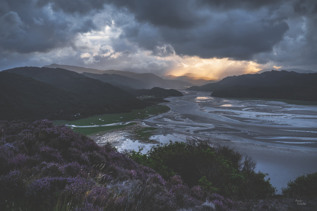
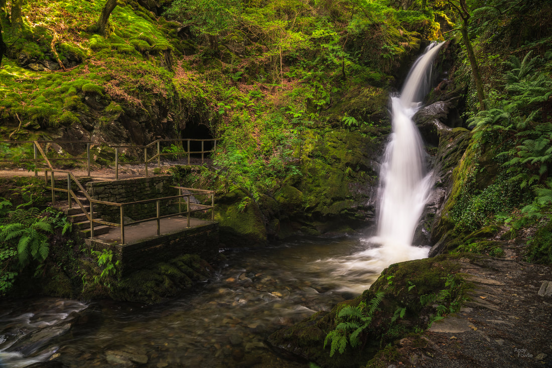
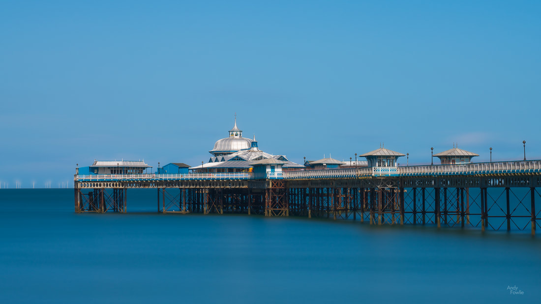
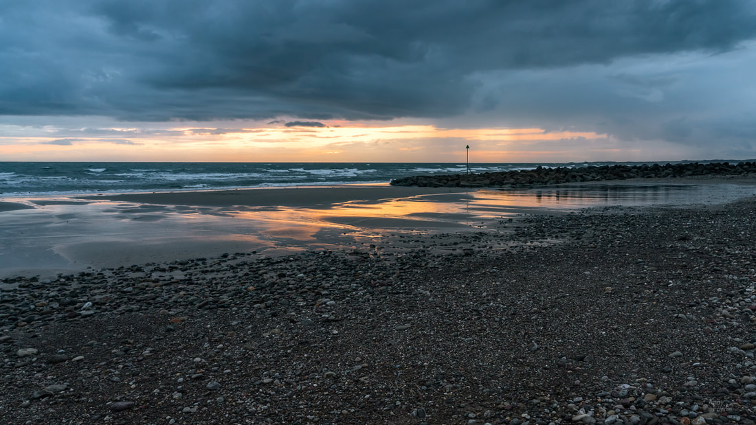
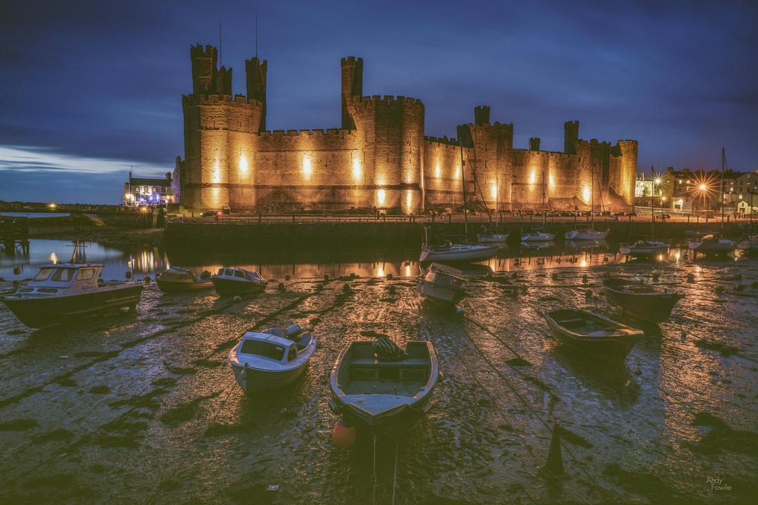
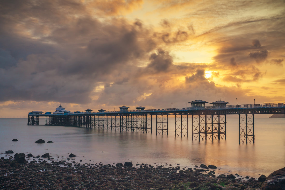
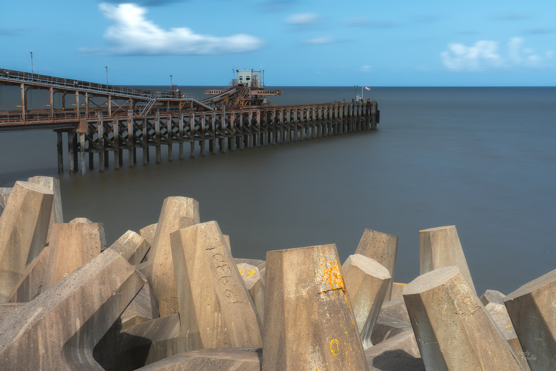
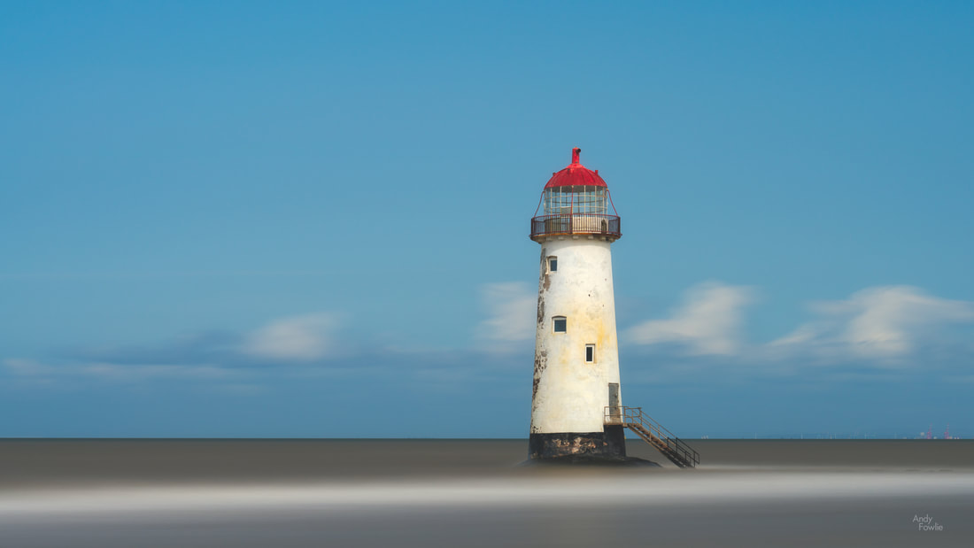
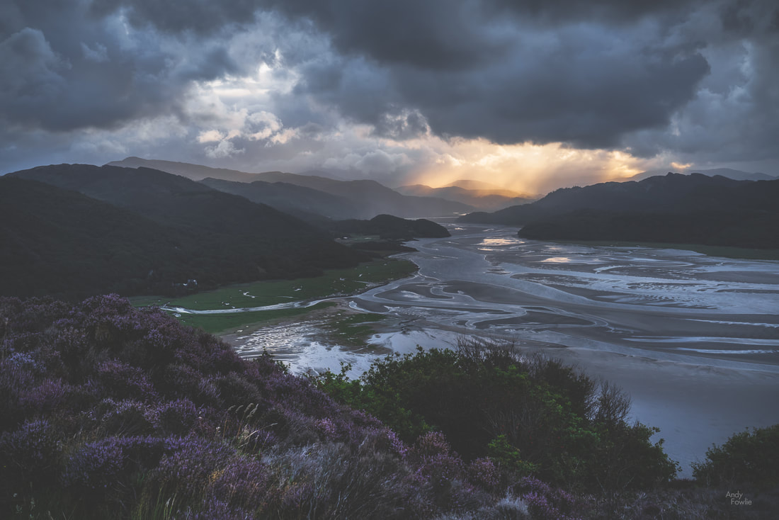
At 0345 my alarm sounded. I did not even have to open my eyes in order to judge the weather conditions, the wind was hurling raindrops with remarkable ferocity against my west facing window in the Fron Deg Guesthouse. A beautiful sunrise seemed monumentally unlikely. On days like this it can be overwhelmingly tempting to stay under the covers and start the day with a lazy breakfast instead of some foolish adventure. Six or seven minutes later i was on the road, heading towards a location near Barmouth. After a 30 minute drive, the final section of which took me up a rather narrow track, I started hiking through a forest in the darkness, following a trail which should deliver me to a viewpoint. The rain was intermittent, but did not cause much hardship while I was under the cover of the tree canopy. As the ambient light began to reveal more of my surroundings I got my first few glimpses of the Mawddach estuary through some gaps in the trees. As the trees gave way to heathery scrub at the top of the hill the full panorama revealed itself, but the weather conditions were ugly and boring. I took a few shots, without much enthusiasm and then got distracted by some interesting rocks and tried to find abstract patterns to photograph. At least I had got myself out of bed, and had a nice morning walk. I decided to head back for breakfast. I walked back down the hill a bit... then changed my mind and decided to use the time to practice shooting timelapses, something I have been meaning to get into. I set a timelapse going and then resumed my seach for patterns in the rock. A few minutes later I looked up and saw that the sun was starting to fight it's way through the clouds... a magnificent sight. My timelapse was still running, and indeed it had captured the progression of this elemental battle as raged above the estuary, driven on by the westerly wind. Timelapse photography involves shooting a large number of images of a scene and then using those images as frames in a video. The resulting footage has some noticeable differences to normal video content, the most striking of which is that it can be used to show changes over a significant length of time in a relatively short clip. The timelapse above is made from 900 images, captured once every 2 seconds over a period of 30 minutes, the resulting footage has a duration of 30 seconds. I have done some experiments with this kind of work over the past few trips and start to be more proficient with both the capturing and processing of timelapse footage. I think that there will be the occasional timelapse to be seen in my future posts. There is nothing much better than the feeling you get when sitting down to a good breakfast with the thought that the day has already been worthwhile. The morning routine following a sunrise excursion has a familiar pattern - cereal, sausage, bacon and eggs, toast, orange juice and coffee... probably more coffee... copy the morning's pictures to my laptop, charge batteries, shower, get dressed and head out exploring. My next destination was a bit of a drive away, I followed the road along the coast, around the Mawddach estuary and into the countryside to Dolgoch Falls. This beautiful forest waterfall has an excellent cafe (the Dolgoch Tea Rooms) nearby and some possibilities for a bit longer walks nearby. I sometimes get asked about how my images are processed, and that seems to be one of the major topics of debate in the photography community as well as in the looking at photography community. A few weeks ago I wrote down my own thoughts about such discussions in a short article that you can read here. As a follow up to that article, for those who prefer to see some concrete examples, I made another post showing a before and after comparison for two finalised images (including the one above). For the final couple of days of this most enjoyable trip I moved my base of operations to the town of Llandudno, where one of the attractions is a grand old pier. Most of the places that I found interesting in this area were beside the sea. There are many beaches and coastal areas, each with different characters and features. The long, west-facing, rocky beach at Dinas Dinlle was a great place to watch the sunset and it also has a decent fish and chip shop right next to the car park... what more could anyone possibly want? Another feature of this area is remarkable castles, two particularly fine examples are preserved at Conwy and Caernarfon, both of which date from the 13th century. By this stage of my journey the constant late night-busy day-early morning routine was starting to have a cumulative effect. In autumn and spring it is quite possible to go on almost indefinitely shooting both sunrise and sunset every day, but in summer the period between those is just too short to get enough sleep. It was something of a relief to have the possibility to get to my sunrise destination the next morning with a 400m walk from my accomodation instead of a long journey. On my final full day in Wales I decided to explore along the north coast, stopping first at Llandulas beach where there are some interesting coastal defences. Thousands of huge concrete blocks, shaped something like jacks (from the classic game, it's just a matter of time before modern youngsters leave their devices behind and return their efforts to games like this), are piled up along a 7 mile stretch of coast. The most obvious, and already much photographed, landmark to add to any picture of these sea defences is Raynes Jetty, a structure extending out to deep waters in order to allow cargo ships to be loaded with the products of the nearby Raynes Quarry. At the most northern extreme of the Welsh mainland you can find the golden sands of Talacre beach and their crowning glory, the Point of Ayr lighthouse which sits out in the surf, about 50m offshore, at high tide but can be approached on foot across the sand at low tide. My first visit to North Wales was a most enjoyable one, and I am sure that i just scratched the surface of what it had to offer. I hope that I can return one day, maybe in some better conditions so that I can explore more widely in the mountains of Snowdonia. Thanks for your attention and support! Until next time, Andy
4 Comments
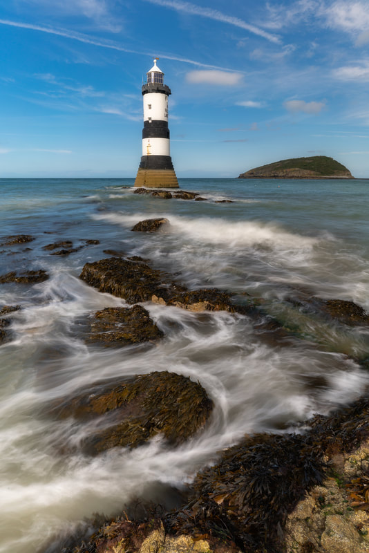
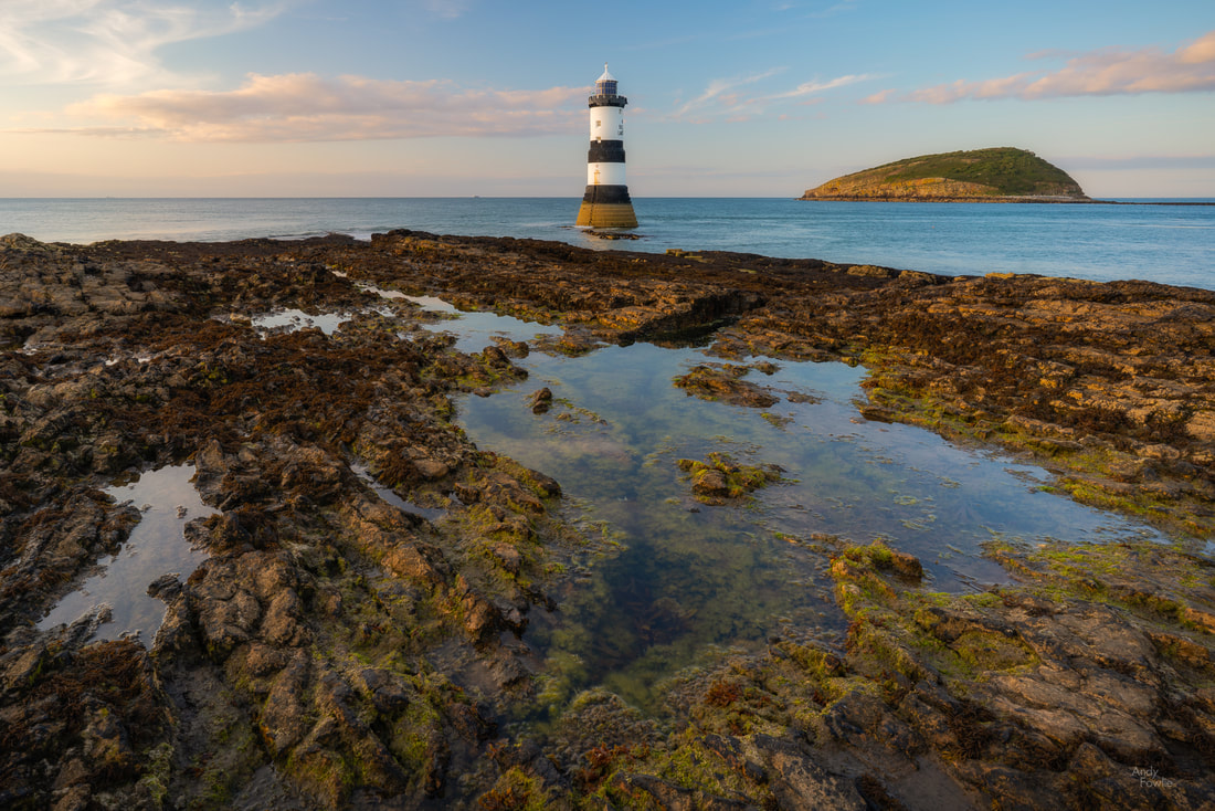
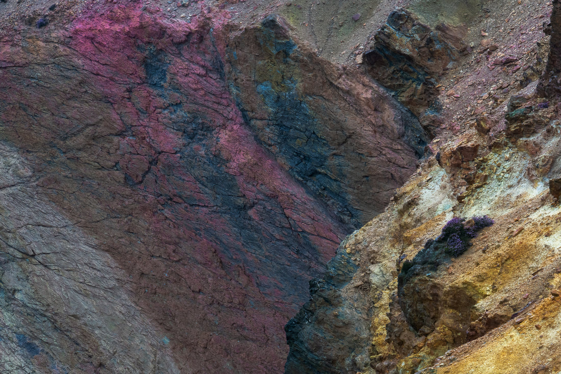
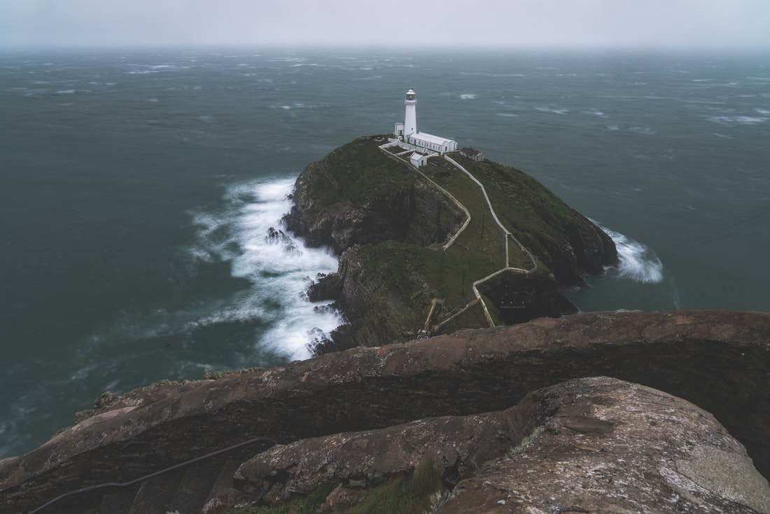
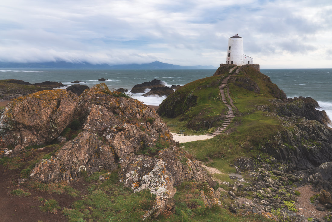
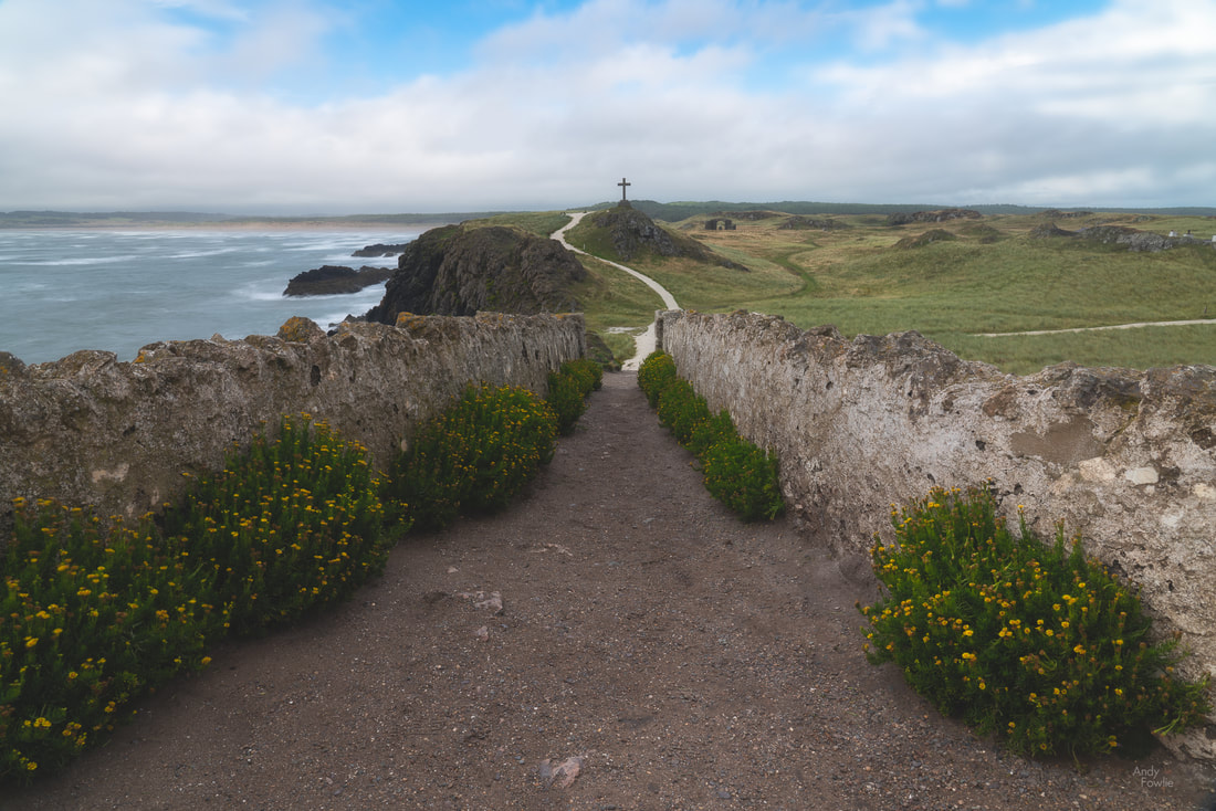
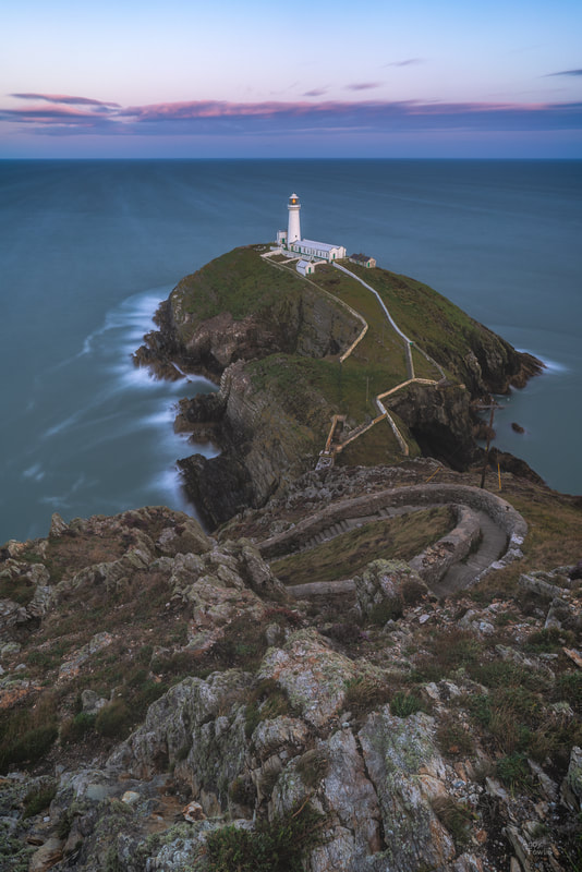
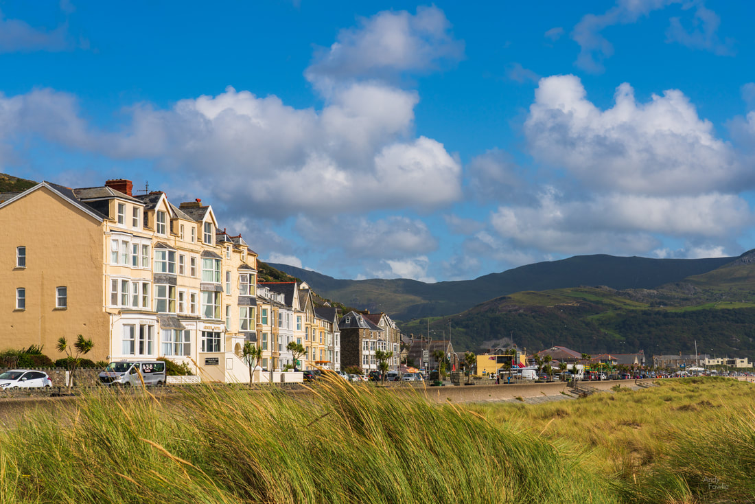
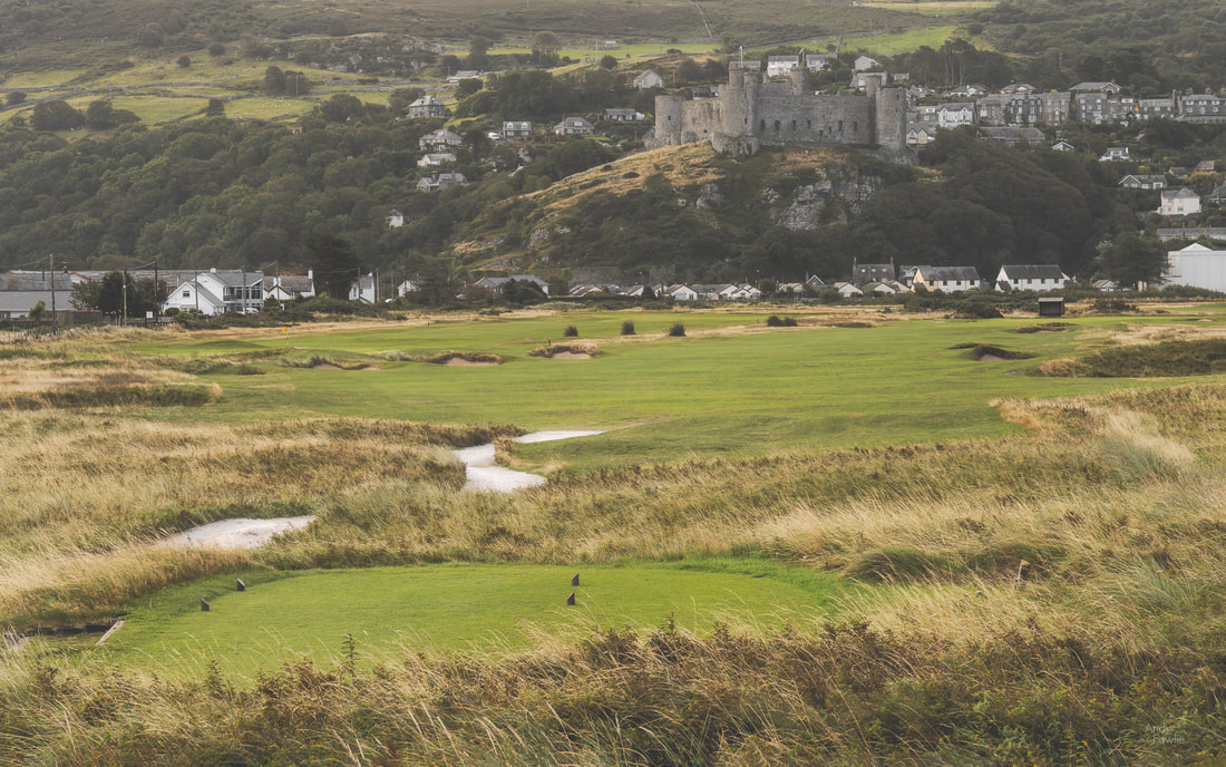
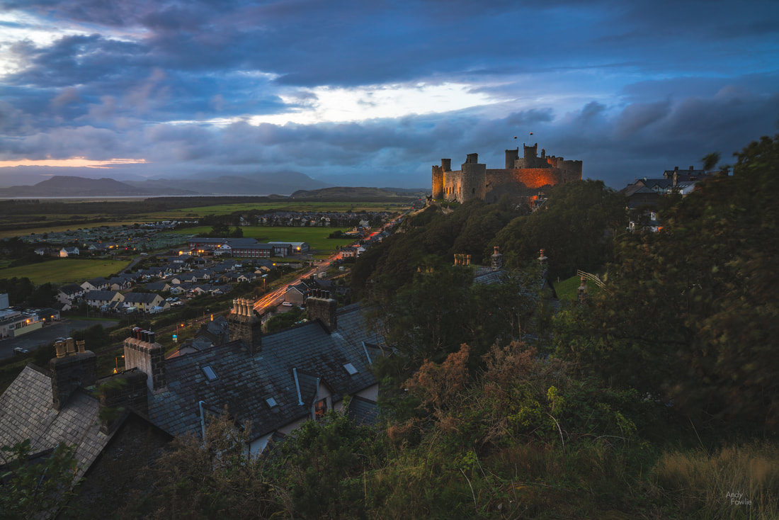
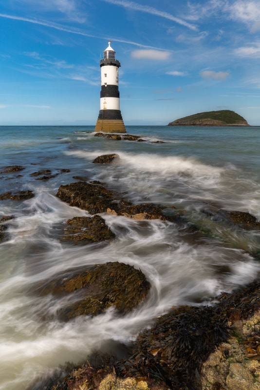
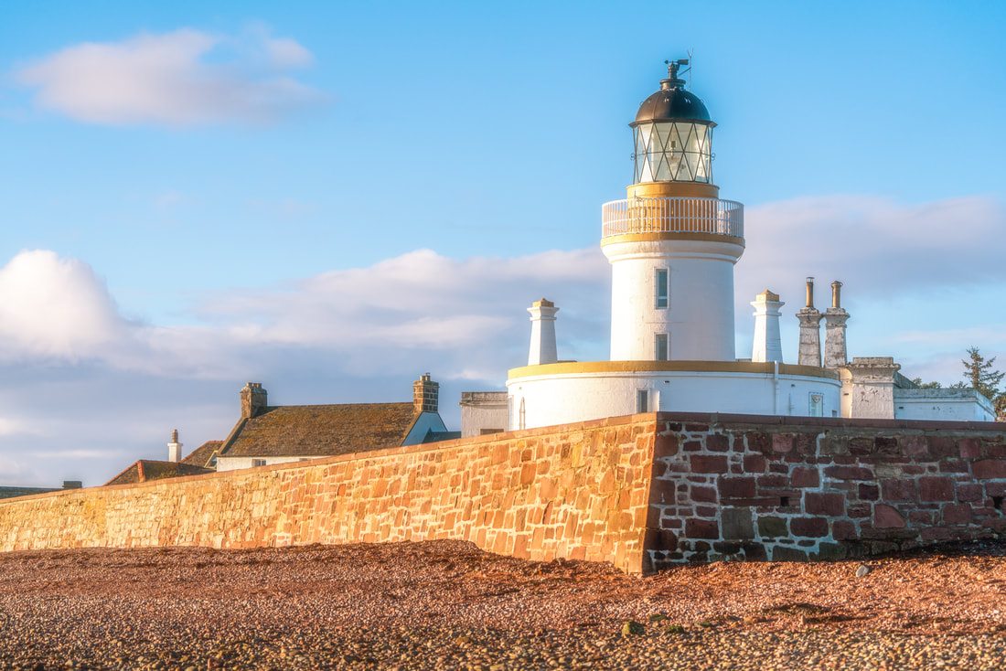
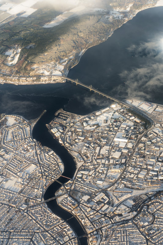
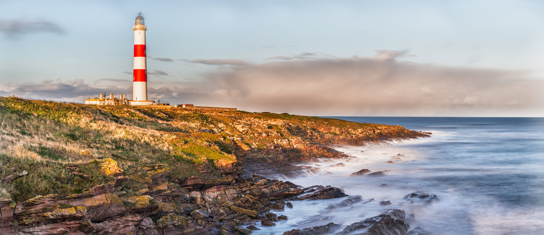
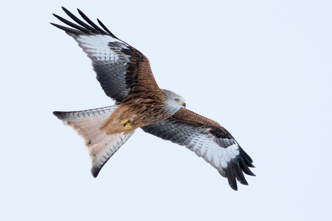
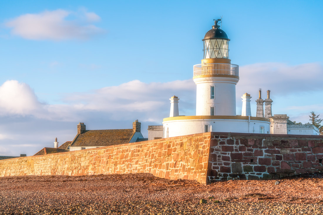
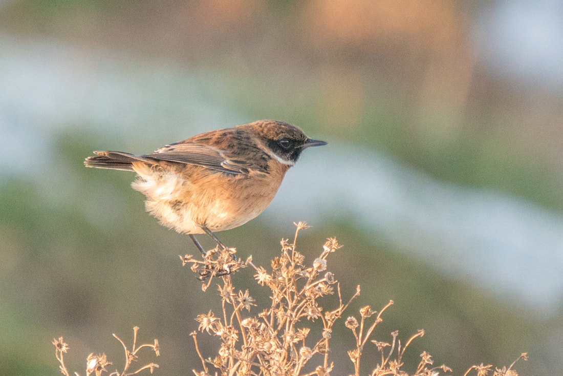
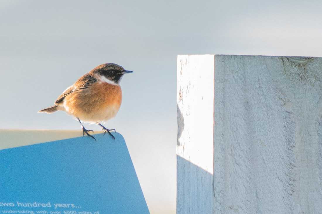
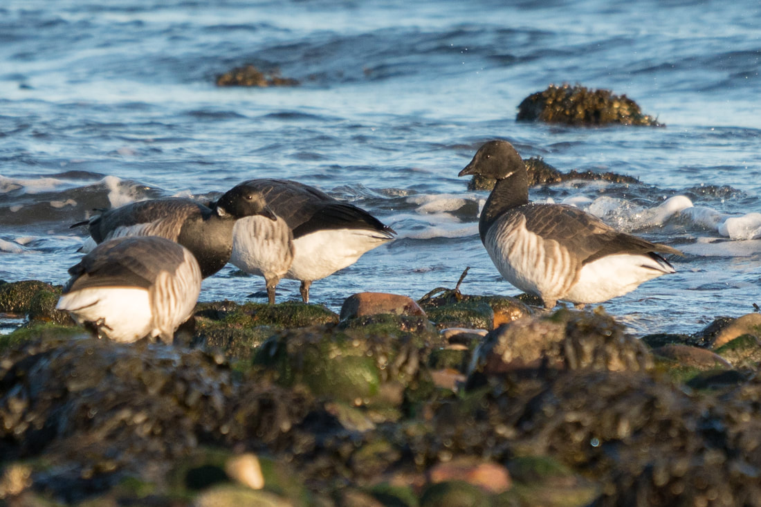
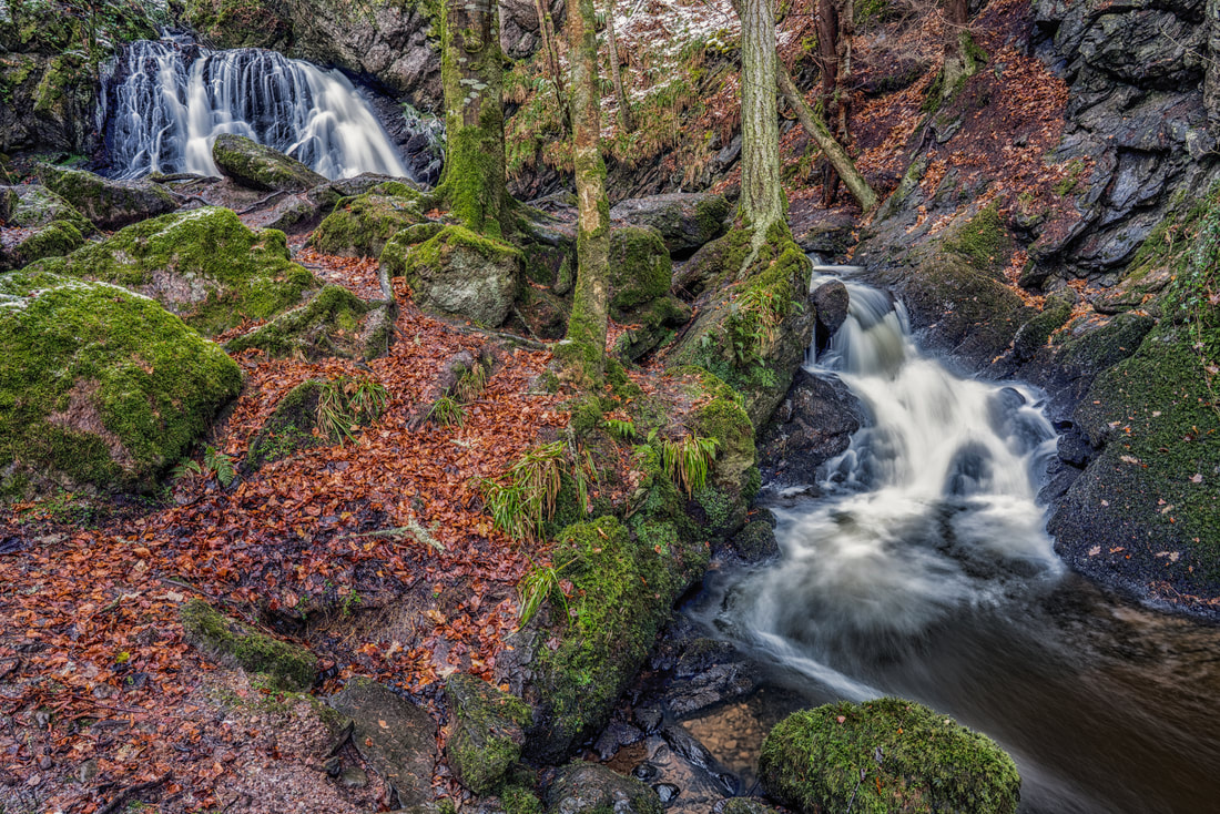
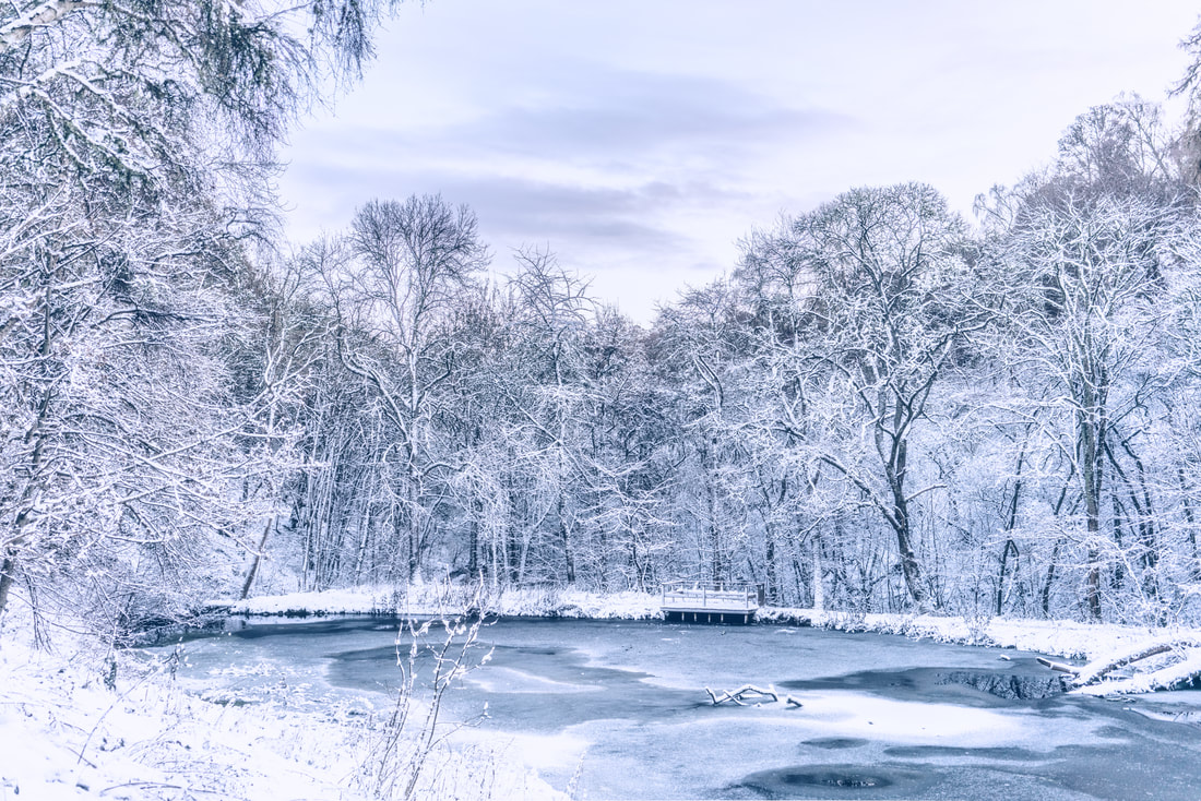
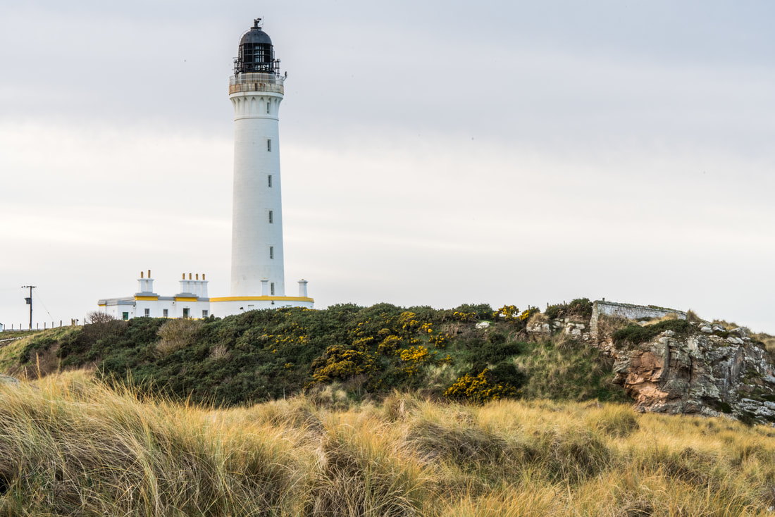
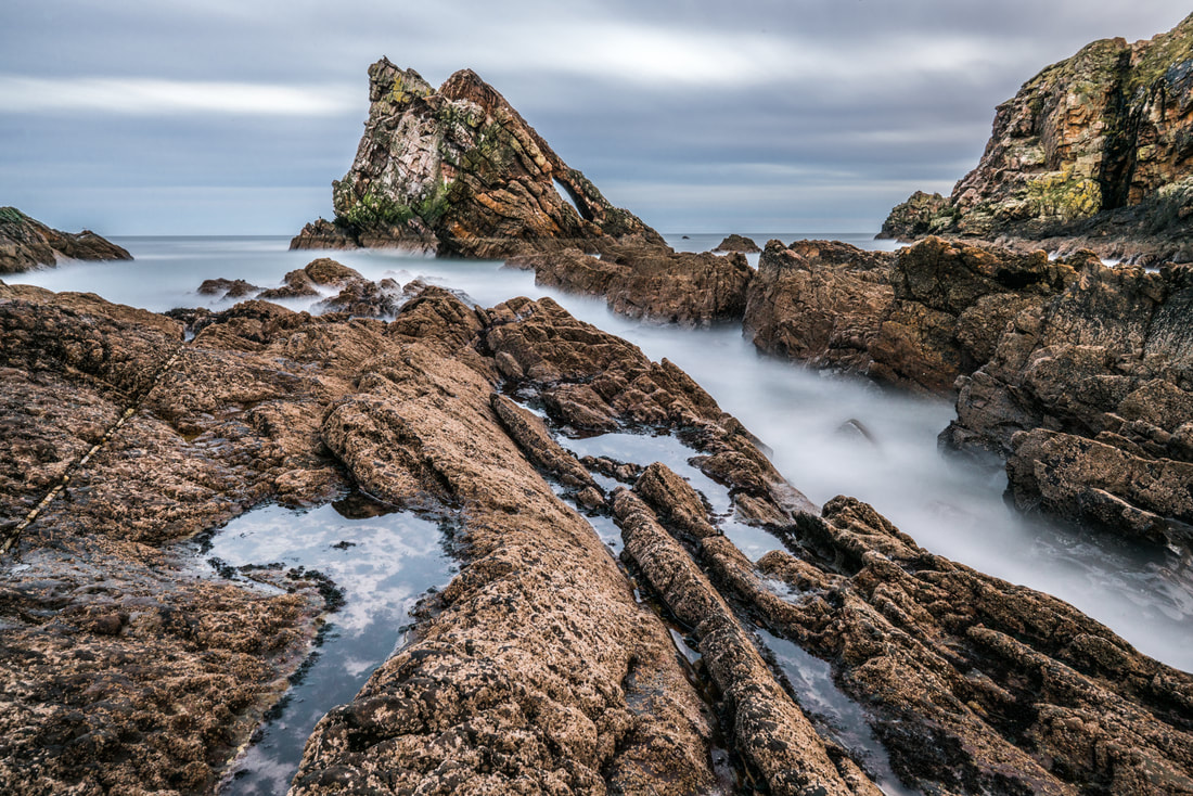
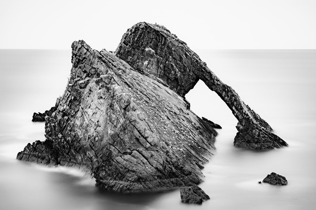
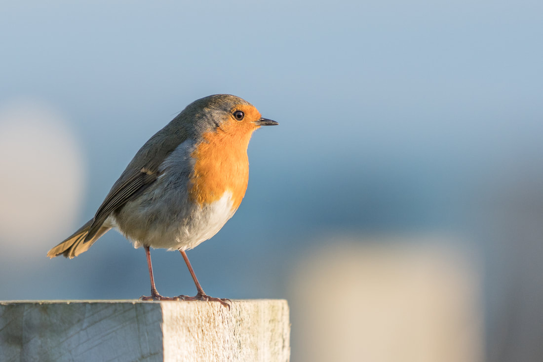
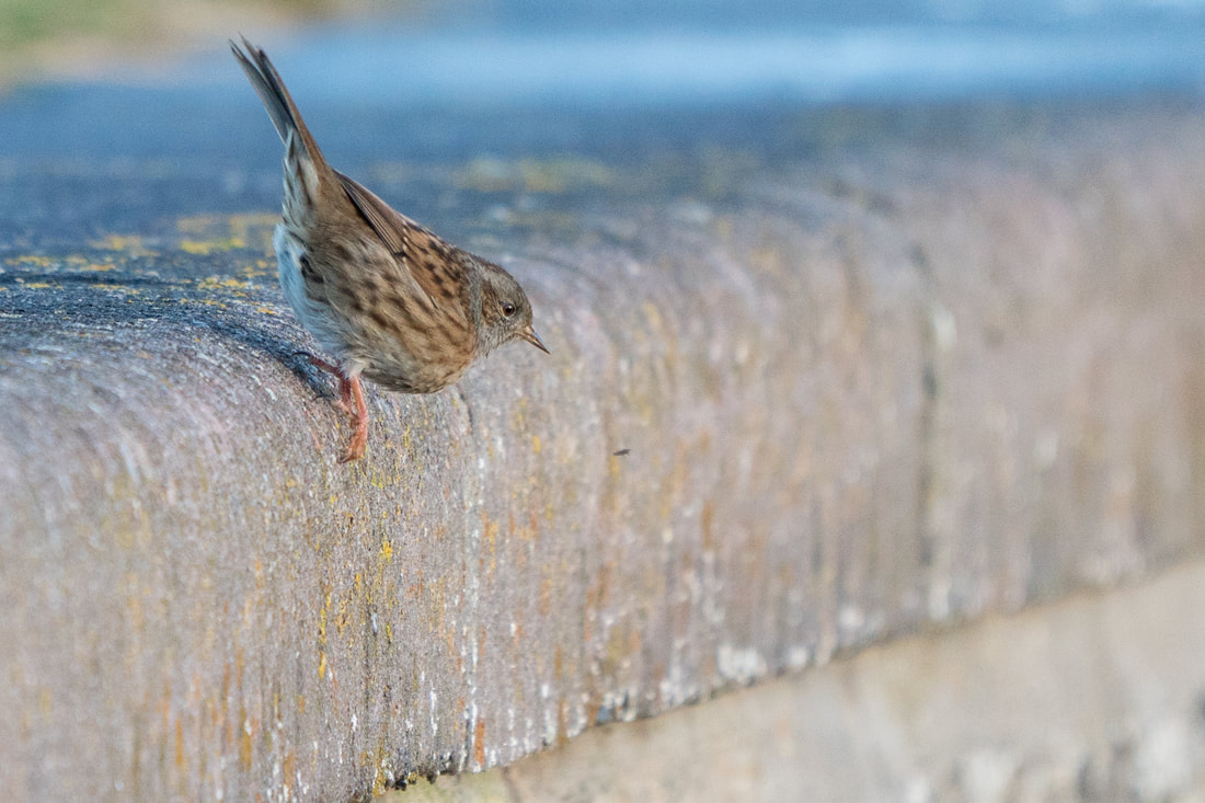
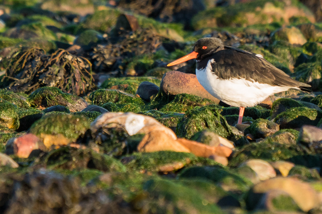
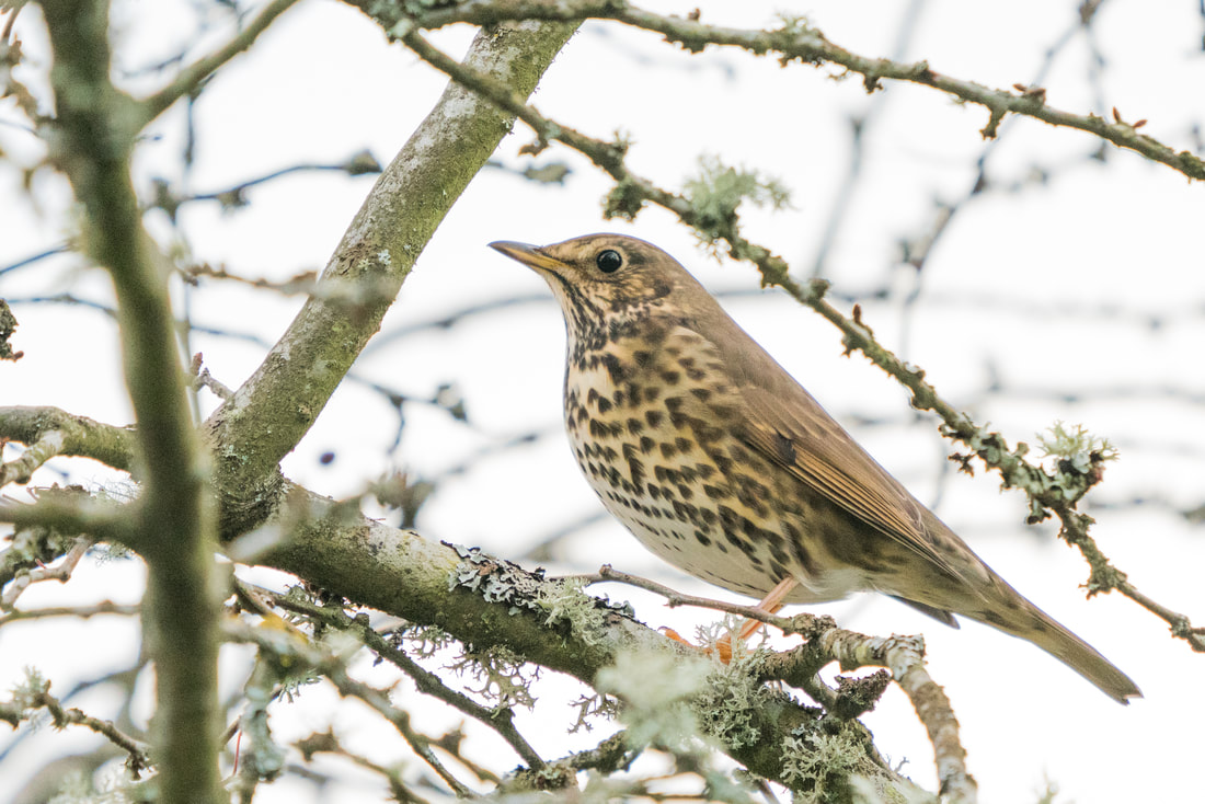
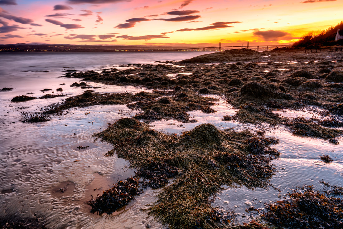
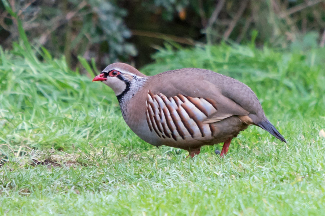
I am not sure if I will still have any readers after offering extensive thoughts on the art of cricket commentary in my last post, but if anyone ever reads this then please know that I am most grateful for your patience. Having left Snowdonia behind I made my way north and west to spend a few days on the island of Anglesey. Anglesey is a significant chunk of rock (about 715 square kilometres in area) just off the west coast of the Welsh mainland and it can be reached by road using either the 19th century Menai Bridge or the 20th century Brittania Bridge, both of which cross the Menai Strait just to the west of the city of Bangor. The first location i visited was Penmon Point, at the eastern extreme of the island, here you can find fresh air, sea views and pleasant walks while the Pilot House Cafe can satisfy all your on-site refreshment needs. Lighthouses can make for interesting photographic subjects, often providing the vertical element in an otherwise level environment and frequently positioned in slightly wild locations, surrounded by rocks, cliffs and crashing waves. This would not be the only lighthouse of my time in Anglesey. When planning my trip I had decided that two nights would be spent in Anglesey, meaning that I had an arrival day, a full day and then a departure day. My full day in Anglesey just happened to coincide with the arrival of a major storm. There was fairly persistent precipitation to deal with but the bigger photographic difficulty was caused by monumentally strong winds (67mph = 107kmh =30m/s). Tentatively I headed out into the storm, slightly comforted by the fact that the chances to get my destinations to myself were significantly higher on a day like this. After a completely miserable "sunrise" at Penmon and a restorative breakfast the first location of the day was the old copper mine at Parys Mountain. At a location such as this, a massive open cast mine, there can be some challenges to understand how to capture the character of the place in a photograph... in essence the location is just a huge shallow hole in the ground. To me the most interesting aspect of the scenery was the amazing colours of the soil and sediment, caused (as far as I can find out) by the presence of metallic oxides. The wind was far too strong for even a heavy tripod and the driving rain was an impediment for shooting in many otherwise possible directions so I was reduced to capturing quick hand-held shots inbetween attempts to clear the moisture from the front element of my lens. It is both a benefit and a matter for some regret that i have had so many opportunities in 2019 to develop such techniques. Despite the weather Parys mountain was a most interesting place to visit. I do enjoy being out and about at interesting locations no matter what the weather conditions may be and I expect to encounter a variety of conditions over time, 2019 has however been remarkable for a lack of variety as heavy rain and strong winds have been a constant companion. I shall endeavour to ensure that my posts contain something of interest (ok, ok, no more cricket stuff) in addition to complaints about the weather. My journey continued and I drove towards Holy Island (a 39.4 square kilometre island located just west of the island of Angelsey, which is located just west of the British mainland which is an island just to the west of the European mainland) from where I intended to photograph the lighthouse at South Stack... which is located on a tiny island just to the west of Holy Island. The path leading down the cliff side to South Stack from the car park is completely exposed to the worst of the elements. The stone walls to the side of the path protect you well from any accidents, but the wind made shooting of any kind exceptionally difficult, 95% of my attempted pictures ended up as a blurry mess. I resolved to return at sunrise and try again, despite the fact that I would need to set my alarm for 0345. I made my way back in a southerly direction along the east coast of Anglesey, towards a place called Llanddwyn Island. The island can be accessed on foot along the nearby beach but it is cut off from the mainland at high tide so some sensible planning is required in order to reach it and leave it again without having to wait around for a few hours at either point. This island and surrounding area have many paths which lead through the beautiful dunes and you can also find yet another lighthouse, the Twr Mawr lighthouse, built in 1837. The afternoon weather was at least slightly more pleasant, the strong winds persisted but the rain finally gave way to a mixture of sunshine and cloud which can be an attractive combination. I did make it to South Stack the following morning, well before the sunrise, but I was not rewarded with anything particularly interesting in terms of light or colours. It was at least much easier to stand up and importantly to use a tripod seeing as the storm had finally moved on. I believe that sunset might be a better proposition at this spectacular location on a suitable day. Leaving Anglesey behind I continued my journey, a few days in South Snowdonia, based in a small village near to the town of Harlech. The weather took a temporary turn for the better and as I had a look round the town of Barmouth in the afternoon it was possible to believe that it really was August in Wales and not November in the Arctic. Harlech itself is a nice old town perched on a hillside with a very beautiful sandy beach which stretches for many miles and a mountainous landscape of dunes covered with marram grass. The famous golf course played over by the members, guests and visitors of Royal St. Davids Golf Club occupies some beautiful links land adjacent to the dunes and offers some nice views towards the other main highlight of the town, the castle. There are a few possible vantage points within the town from where you can get a good view of the castle with the mountains of Snowdonia in the background. Well, that's it for this time, tune in again next week for the final chapter of my report from North Wales. Andy Recent Posts Hi everyone, and apologies for a period of inactivity in my blog. First I was travelling, then I was a bit unwell, then it was Christmas... and all of a sudden it has been four weeks since my last post. Now that I have made my excuses, perhaps I can tell about my trip to Scotland for 12 days in December. As some of you will realise, this trip took me to my country of origin. My intention this time was to split my days between exploring with my camera and catching up with friends and family - my parents, brothers, sisters-in-law, nieces and nephews all still live in Scotland and it was high time for a visit. My journey to Inverness was somewhat more complicated than it should have been due to unfavourable weather conditions. Firstly my flight from Helsinki to Amsterdam had to divert to a small military airport in Groningen for refuelling, Amsterdam was reduced to a single operating runway by fog and wind and we did not have enough fuel to go round in circles waiting our turn. After a 2 hour wait in the plane on the tarmac in Groningen we finally made the short hop to Amsterdam. My second flight, from Amsterdam to Inverness, went without incident until we were above Inverness, at which point the captain informed us that the airport was currently closed due to heavy snow... so we went round in circles overhead for 90 minutes while they cleared the runways. This did however offer some great views of the snow-covered city. The weather which disrupted my flights, would also disrupt many of my other plans. Living in Finland I am very used to freezing conditions and driving on snowy or icy roads, but I felt like it was wise to be a bit more cautious when driving an unfamiliar car on unfamiliar roads without the benefit of winter tyres. I had hoped to travel all around the north and west of Scotland, including the Isle of Skye, but instead I stayed within a couple of hours drive of my parents house near to Inverness for most of my trip. Luckily there was plenty of interesting things to point my camera at without travelling more widely. I decided to visit the lighthouse at Tarbat Ness, an impressive 53m tall specimen built in 1830 by Robert Stevenson (the grandfather of Robert Louis Stevenson) as part of the response to a great storm in 1826 which had resulted in the loss of 16 vessels in the Moray Firth. The lighthouse still operates today, fully automated, and it's light can be seen for over 40 kilometres (on the rare clear days in this part of the world). The location is somewhat remote on the end of a peninsula, ideal lighthouse locations are not always the most convenient to journey to. Tarbat Ness was also a good place to observe birds, I spotted chaffinches, robins, dunnocks, rock pipits and blue tits as well as being almost continually accompanied by the sound of wrens as a I explored the area. There were noticeably more birds than there are in Finland at this time of year. Over the course of the following few days I spent some time walking with my camera near to Kilmuir, in search of bird species that I had not previously photographed. There were two particular prizes that I was seeking, the red kite (a bird of prey which is rather hard to find in Finland) and the red-legged partridge (a small game bird that can't be found in Finland at all). The red kite is historically a native bird in Scotland but had disappeared from these parts until a successful effort to reintroduce it at the end of the last century, relocating 93 birds from Sweden for the purpose. Thankfully, nowadays, it is possible to see these beautiful birds more regularly, I was able to see one or more of them at least every second day during my trip. When it comes to the red-legged partridge, my hunt for that prize was not so straight-forward, every time I went out with my camera I would come back empty handed. After one such failed search I sat at the kitchen table having coffee, only for a red legged partridge to walk slowly past on the street outside, about 1 metre away... unfortunately my camera was not with me. Sometimes that's how things go. My next lighthouse was at Chanonry Point, a narrow spit of land in-between the villages of Fortrose and Rosemarkie which is one of the best places in the world to observe dolphins from the shore. This lighthouse was also built by a Stevenson, this time Alan Stevenson (son of Robert, uncle of Robert Louis), and it was completed in 1846. It still operates, fully automated since 1984. I was not lucky enough to see any dolphins while at Chanonry Point but there were many birds in the immediate area including oystercatchers, robins, dunnocks, sparrows and a goldcrest - but the most interesting species I saw was a stonechat, the 167th species I have photographed this year. From Chanonry Point I continued round the coast to Rosemarkie where I spotted a flock of Brent Geese on the beach... species 168. From Rosemarkie beach I followed a path through the forest to some fairy pools. The sign promised that it was 500m to my destination so after walking up a hill for 25 minutes I started to have some doubts about whether I was on the right path, but when turning the next corner they were right in front of me. It was a bit curious that this area was almost free of snow while lower down in the valley there was a thick white blanket covering everything. The lighthouse project continued as my father and I took a day trip, following the Moray coast east to the town of Lossiemouth where the impressive Covesea Skerries lighthouse can be found. Another Stevenson design (Alan once again), this lighthouse was built in 1846 as another part of the recommended response to the storm of 1826, it's light was finally extinguished in 2012 but the iconic structure remains. From Lossiemouth we continued east to the town of Portknockie where the quartzite rock that makes up the local coastline has eroded into interesting shapes, the most famous of which is Bow Fiddle Rock, an interesting protrusion about 50 metres away from the coastal cliffs. As we returned from our trip to Portknockie I was again taunted by the elusive red-legged partridge. This time there were a pair of them sitting on the neighbours doorstep. They were very close and not that concerned by our presence... but it was about 2 hours after sunset and way too dark to take bird photographs. On the second weekend of my trip I headed south to Leven, near Edinburgh, to visit my nephews. It was a particular highlight to be able to watch the new Star Wars movie with them in St Andrews after visiting their favourite bookshop. After returning to Kilmuir again the red-legged partridge was on my mind. Time was running short to get a photograph. Wondering around with my camera brought all kinds of birds into view, but not the one I was looking for... as compensation I was at least treated to a nice sunset. Although I didn't find the partridge, I had a lucky encounter with another Kilmuir resident who gave me a tip about where I might see some partridges early the next morning, before my flight back to Finland. A dawn stakeout, hiding under some tall bushes, was finally rewarded (after 80 cold minutes) with the sight of a pair of nervous red-legged partridges. They were a bit smaller than I expected, about the size of a pigeon, and behaved in a similar way to pheasants, preferring to walk or run away from any perceived danger instead of using their wings and taking to the air. The bird was a bit distant and the sun was below the horizon so the picture is no masterpiece, but at least it gives an idea how these distinctive birds look, and also takes my 2017 photographed species count to 169. Thanks to all who have shown an interest in my blog and my photographs during 2017, I wish you a happy new year and a great 2018. Andy |
AuthorAndy Fowlie See also:
SubscribeEnter your email address to receive notifications of new blog posts
Archives
December 2019
Categories
All
|
- Hub
-
Portfolio
- Flow 2019
- magical Vestrahorn 2019
- Fangorn 2019
- a snowstorm at Kintail 2019
- the village 2019
- a bolt from the blue 2019
- peaceful purple pastels 2019
- a Slovenian sunrise 2019
- the cormorant 2019
- Elgol on the rocks 2019
- weeds 2019
- pretty in pink 2019
- Ritsons Force 2019
- Sakrisoy on the Rocks 2019
- the Clappersgate eye 2019
- the Falls of Falloch 2019
- in the jaws 2019
- the devils teeth 2019
- tranquility 2019
- the old man of storr 2019
- Destinations unknown
- Articles
- Recognition
- Contact
- Store
- About



 RSS Feed
